

Click Image to Enlarge
Pennsylvania Counties
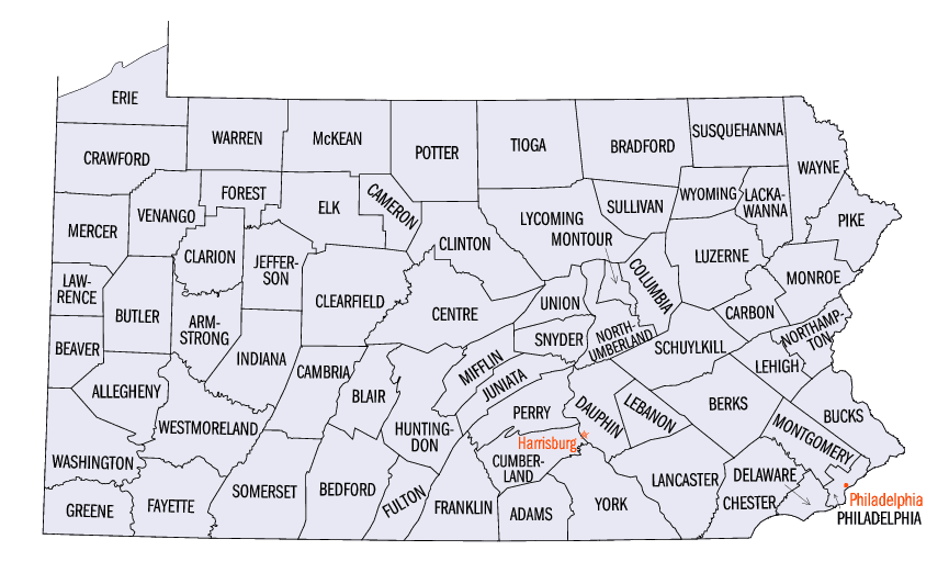
There are sixty-seven counties of the Commonwealth of Pennsylvania in the United States of America. The city of Philadelphia is coterminous with Philadelphia County, and governmental functions have been consolidated since 1854.Pike County, Pennsylvania
Pike County Education, Geography, and History
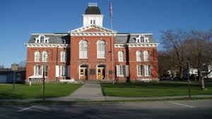
Pike County is a county located in the state of Pennsylvania. Based on the 2010 census, the population was 57,369. Its county seat is
Milford.
Pike County is included in the New York-Newark-Jersey City, NY-NJ-PA Metropolitan Statistical Area.
Etymology - Origin of Pike County Name
Named for General Zebulon Pike.
Demographics:
County QuickFacts: CensusBureau Quick Facts
Pike County History
Created on March 26, 1814, from part
of Wayne County and named for General Zebulon Pike. Milford, the county seat,
was incorporated as a borough on December 25, 1874, and probably named for
Milford Haven in Wales.
Originally a remote section of Bucks County, the land that became Pike was first
settled about 1700. Purchases from the Indians in 1749 and 1768 legitimized
settlement, and an agreement with Connecticut in 1786 confirmed Pennsylvania's
authority. Violence with Native Americans lasted through the Revolution. Milford
was settled in 1796 and just kept growing. Millwrights and ferry masters were
early settlers. Canals, beginning in 1827, made Pike a connecting point with New
York, and an aqueduct was built to carry canal boats over the Delaware.
Railroads arrived in 1848, and lumber was rafted out to Easton and Trenton. A
tanning industry once flourished, and bluestone quarries were productive. The
population grew with the lumbering industry, but by 1914 the stands of trees
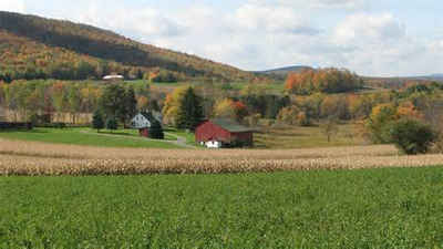
were exhausted. Few stayed on. Although rural, Pike is not a significant farming
area. The summer tourist population, a feature for over a century, is often ten
times the permanent population. Farms occupy only 1½ percent of the land. Many
national leaders spent creative periods secluded in Pike: Charles Peirce, Dan
Beard, Grover Cleveland, William Howard Taft, Thomas Edison, Zane Grey, and
Horace Greeley, for example.
Geography: Land and Water
As reported by the Census Bureau, the county has a total area of 567 square miles (1,468 km2), of which, 547
square miles (1,416 km2) of it is land and 20 square miles (51 km2) of it (3.50%) is water.
The terrain rises rapidly from the river valley in the east to the rolling foothills of the Poconos in the west. The
highest point is one of two unnamed hills in Greene Township that top out at approximately 2,110 feet (643 m) above
sea level. The lowest elevation is approximately 340 feet (103.6 m), at the confluence of the Bushkill and the
Delaware.
Neighboring Counties
Bordering counties are as follows:
- Sullivan County, New York (north)
- Orange County, New York (east)
- Sussex County, New Jersey (southeast)
- Monroe County (southwest)
- Wayne County (northwest)
Education
Public school districts
Delaware Valley School District
East Stroudsburg Area School District (also in Monroe County)
Wallenpaupack Area School District (also Wayne County)


Click Image to Enlarge
