

Click Image to Enlarge
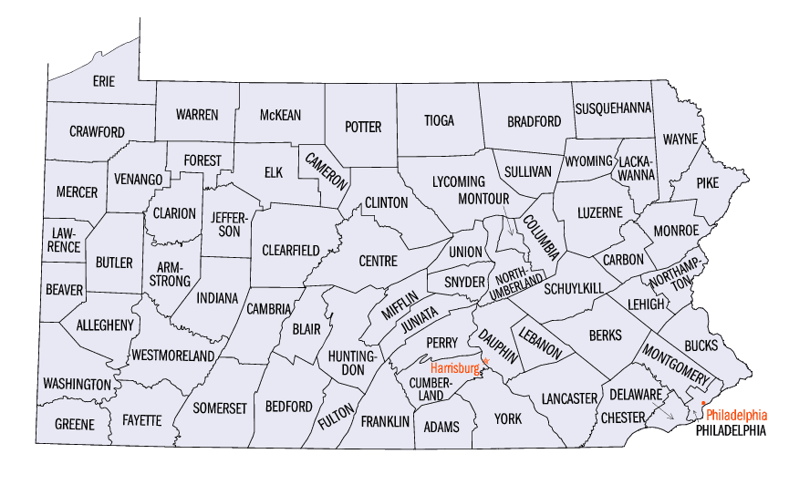
Pennsylvania Counties
There are sixty-seven counties of the Commonwealth of Pennsylvania in the United States of America. The city of Philadelphia is coterminous with Philadelphia County, and governmental functions have been consolidated since 1854.Schuylkill County, Pennsylvania
Schuylkill County Education, Geography, and History
Schuylkill County is a county in the Commonwealth of Pennsylvania. Based on the 2010 census, the population was 148,289. The county seat is
Pottsville. The county was created on March 1, 1811 from parts of Berks, Northampton, and Northumberland Counties and named for the Schuylkill
River.
Schuylkill County comprises the Pottsville, PA Micropolitan Statistical Area.
Etymology - Origin of Schuylkill County Name
Named for the Schuylkill River. "Schuylkill" is Dutch for "hidden stream."
Demographics:
County QuickFacts: CensusBureau Quick Facts
Schuylkill County History
Created on March 1, 1811 from parts
of Berks and Northampton Counties and named for the Schuylkill River.
"Schuylkill" is Dutch for "hidden stream." Parts of Columbia and Luzerne
Counties were added on March 3, 1818. Pottsville, the county seat after December
1, 1851, was incorporated as a borough on February 19, 1828 and became a city in
1910. It was named for the Pott family, early settlers. The original county seat
was Orwigsburg.
Germans from Berks County arrived two years before the land was purchased from
the Indians in 1749. This was the scene of Indian raids and frontier forts in
the French and Indian and Pontiac Wars, and of brief Indian raids during the
Revolution. Necho Allen in 1790 discovered that anthracite coal would burn, and
Col. George Shoemaker proved in 1812 that it could fire a rolling mill. In 1822
the first shipment of anthracite on the Schuylkill Canal spurred mining. The
county has some of both the Southern and Middle anthracite fields. From 1880 to
1940 it was second only to Luzerne in production. In 1842, the Reading Railroad
arrived, but the canal carried coal also until 1881. A second generation began
mining the northern area using inclined plains. The railroads owned the majority
of the mines. Mining technology was first worked out in Schuylkill, also the
scene of early mine labor troubles. Pottsville did not develop an anthracite
elite comparable to Wilkes-Barre, Scranton, and Mauch Chunk, because most of its
capital came in from Philadelphia. The coal strikes of 1902 and 1925-1926
destroyed consumer confidence and alternative heating fuels cut into
anthracite's market. Despite a World War II revival, the industry collapsed. The
population peaked at 235,505 in 1930. Strip mining began shortly after 1900.
Bootleg coal operators prevailed between 1930 and 1940 due to the collapse of
the old corporations. In the heyday of anthracite production, the county
competed with Lackawanna as the state's second-most productive county. In 1990
Schuylkill produced half of Pennsylvania's 3.4 million tons. Other county
products have included explosives, textiles, apparel, and shoes. One-fifth of
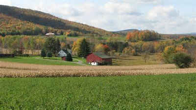
the land is farmed, and the county has a strong position in the production of
swine and potatoes.
Geography: Land and Water
As reported by the Census Bureau, the county has a total area of 783 square miles (2,027 km2), of which, 778
square miles (2,016 km2) of it is land and 4 square miles (11 km2) of it (0.54%) is water.
The Schuylkill River headwaters are found in the county, starting in the Appalachian Mountains, and flows through
many towns and the city of Reading, Pennsylvania to Philadelphia where it flows into the Delaware River. The
Schuylkill drains the majority of the county while some western and northern areas of the county are drained by the
Susquehanna River. The Swatara Creek, Wiconisco Creek, Mahantango Creek, Mahanoy Creek, and Catawissa Creek all
start in Schuylkill County and are tributaries of the Susquehanna. Small areas of the eastern portion of the county
drain into the Lehigh River via the Quakake Creek, Nesquehoning Creek, Mahoning Creek, and Lizard Creek, all of
which also start in the county. To the south, southern Schuylkill county is home to Blue Mountain and the
Appalachian Trail. Broad Mountain crosses the county from northeast to southwest.
Neighboring Counties
Bordering counties are as follows:
- Luzerne County (north)
- Carbon County (northeast)
- Lehigh County (southeast)
- Berks County (south)
- Lebanon County (southwest)
- Dauphin County (southwest)
- Northumberland County (northwest)
- Columbia County (northwest)
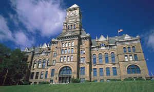
Education


Click Image to Enlarge
