

Click Image to Enlarge
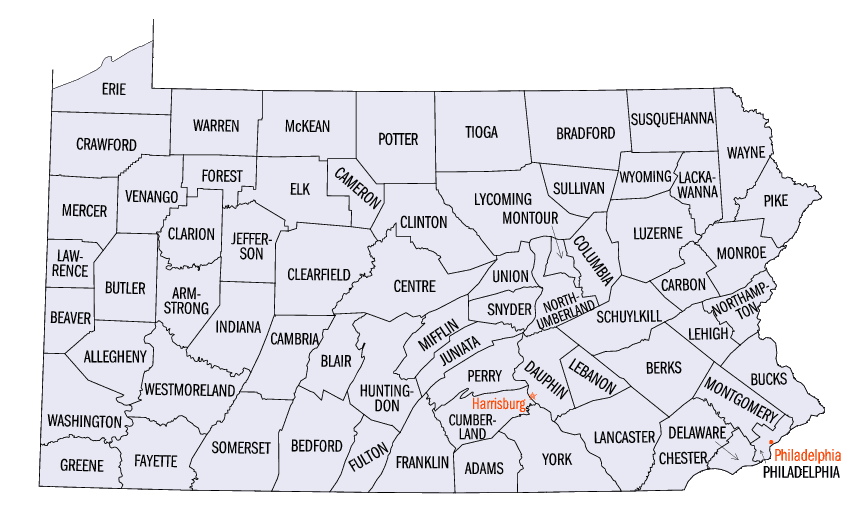
Pennsylvania Counties
There are sixty-seven counties of the Commonwealth of Pennsylvania in the United States of America. The city of Philadelphia is coterminous with Philadelphia County, and governmental functions have been consolidated since 1854.Snyder County, Pennsylvania
Snyder County Education, Geography, and History
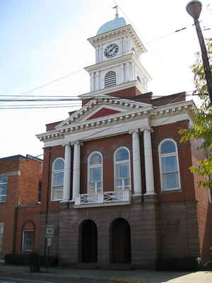
Snyder County is a county in the state of Pennsylvania. Based on the 2010 census, the population was 39,702. The county seat is Middleburg.
Snyder County was formed in 1855 from parts of Union County.
Snyder County comprises the Selinsgrove, PA Micropolitan Statistical Area, which is also included in the Bloomsburg-Berwick-Sunbury, PA
Combined Statistical Area.
Etymology - Origin of Snyder County Name
Named for Governor Simon Snyder.
Demographics:
County QuickFacts: CensusBureau Quick Facts
Snyder County History
Created on March 2, 1855, from part
of Union County and named for Governor Simon Snyder. Middleburg, the county
seat, was laid out in 1800 and incorporated as a borough on September 25, 1860.
It was on Middle Creek near the middle of former Centre Township, so its name
became even more appropriate after the creation the county.
The lower Penns Creek Valley was settled about 1744. The area was included in
the Albany Purchase of 1754. The Penns Creek Massacre of October 1755 was the
start of Indian raids in the French and Indian War. The last Indian raid
occurred in 1781. The population had a strong German element that continues to
the present. The Susquehanna Division of Pennsylvania Canal opened in 1831,
providing jobs and a means to market products. Gov. Simon Snyder lived in
Selinsgrove. A disagreement about a new Union County courthouse led to
separation from Union. A railroad arrived through Middlecreek Valley to
Selinsgrove in 1871. The canal flourished for fifty years until it was destroyed
by ice in 1904; the Middlecreek rail system was discontinued in the 1930s. There
is a tradition of craft industries such as muzzleloaders, furniture, leather,
boats, and shoes. Tanning, lumber, iron mining, and dredging for coal were all
profitable in the past. Crushed stone and timber are still profitably extracted.
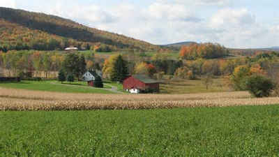
Farms cover 45 percent of the land and are strong in swine, cattle, poultry,
tobacco, and apples.
Geography: Land and Water
As reported by the Census Bureau, the county has a total area of 332 square miles (860 km2), of which, 331
square miles (858 km2) of it is land and 1 square miles (2 km2) of it (0.29%) is water. Snyder County is in the
Appalachian Mountain Section of the Ridge and Valley Province. Two parallel mountain ridges run southwest to
northeast. The Susquehanna River is the eastern border. Between the ridges are steep hills, gently rolling hills,
and flat creek valleys. With over 400 active farms in the county, agriculture plays an important role in the economy
and environment. Roughly half the county remains forested with both softwoods and hardwoods.
Neighboring Counties
Bordering counties are as follows:
- Union County (north)
- Northumberland County (east)
- Juniata County (south)
- Mifflin County (west)
Education
Colleges and universities
Susquehanna University
Public school districts
Midd-West School District
Selinsgrove Area School District
SusQ Cyber Charter School


Click Image to Enlarge
