

Click Image to Enlarge
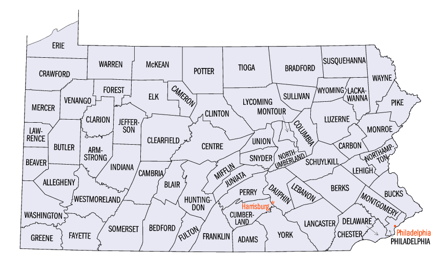
Pennsylvania Counties
There are sixty-seven counties of the Commonwealth of Pennsylvania in the United States of America. The city of Philadelphia is coterminous with Philadelphia County, and governmental functions have been consolidated since 1854.Warren County, Pennsylvania
Warren County Education, Geography, and History
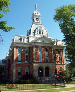
Warren County is a county located in the state of Pennsylvania. Based on the 2010 census, the population was 41,815. Its county seat is
Warren. The county was formed in 1800 from parts of Allegheny and Lycoming counties; attached to Crawford County until 1805 and then to
Venango County until Warren was formally organized in 1819.
Warren County makes up the Warren, PA Micropolitan Statistical Area.
Etymology - Origin of Warren County Name
Named for General Joseph Warren
Demographics:
County QuickFacts: CensusBureau Quick Facts
Warren County History
Created on March 12, 1800, from parts
of Allegheny and Lycoming Counties and named for General Joseph Warren. It was
attached to Crawford County until 1805 and then to Venango County until 1819
when it was formally organized. Warren, the county seat was laid out in 1795 and
incorporated as a borough on April 3, 1832.
French explorers visited the area in 1739 and 1749. Pennsylvania acquired the
land from Indian nations in 1784, in the "Last Purchase." "Mad Anthony" Wayne's
campaign in the Old Northwest, in 1794, finally made it safe for settlers to
stay in northwestern Pennsylvania. David Mead contested the ownership with the
Holland Land Company until 1796. The acrimony raised by "actual settlers" suits
against the powerful absentee land companies' titles slowed the growth of the
area. The Cornplanter reservation land was acknowledged to belong to the Seneca
Indians from 1791 until the Kinzua Dam was completed, in 1964. At first, lumber
was abundant and was floated down many streams to where it could be sold. The
rafting lumber business lasted from 1800 to 1900. Today, second and third growth
trees are harvested and logging companies continue, managed under regulations.
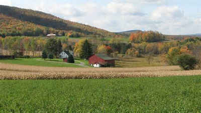
Agriculture and population developed slowly, but oil and gas have been
profitable since the 1870s. The county was especially favored by railroad
access. Warren welcomed the Erie Railroad in 1859, followed by branches of the
Pennsylvania and the New York Central. Metal, concrete, and tobacco products
prospered here in the past. Oil refining and lubricant manufacturing are still
important activities, as is furniture making. In the five years from 1987 to
1992, the county's figure for value added (to the national economy) from
manufacturing rose 86 percent Although 15 percent of land is in farms, meat and
dairying are the areas in which agricultural receipts are competitive with other
rural counties.
Geography: Land and Water
As reported by the Census Bureau, the county has a total area of 898 square miles (2,325 km2), of which, 883
square miles (2,288 km2) of it is land and 14 square miles (37 km2) of it (1.60%) is water.
Neighboring Counties
Bordering counties are as follows:
- Chautauqua County, New York (north)
- Cattaraugus County, New York (northeast)
- McKean County (east)
- Elk County (southeast)
- Forest County (south)
- Venango County (southwest)
- Crawford County (west)
- Erie County (west)
Education
Public school districts
Corry Area School District
Titusville Area School District
Warren County School District (four high schools)


Click Image to Enlarge
