

Click Image to Enlarge
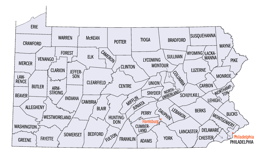
Pennsylvania Counties
There are sixty-seven counties of the Commonwealth of Pennsylvania in the United States of America. The city of Philadelphia is coterminous with Philadelphia County, and governmental functions have been consolidated since 1854.Wayne County, Pennsylvania
Wayne County Education, Geography, and History
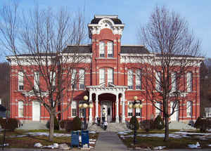
Wayne is a sixth-class county in Pennsylvania. The county's population was 52,822 at the time of the 2010 United States Census. The county seat is the Borough of Honesdale. The county was formed from part of Northampton County on March 21, 1798, and was named for the Revolutionary War General Anthony Wayne
Etymology - Origin of Wayne County Name
Named for General Anthony Wayne.
Demographics:
County QuickFacts: CensusBureau Quick Facts
Wayne County History
Created on March 21, 1798, from part
of Northampton County and named for General Anthony Wayne. Honesdale, the county
seat after 1842, was laid out in 1827 and incorporated as a borough on January
28, 1831. It was named for Philip Hone, president of the Delaware and Hudson
Canal Company. Earlier county seats included Wilsonville (1799-1802), Milford
(1802-1805), and Bethany (1805-1841).
Part of the Pennsylvania lands claimed by Connecticut settlers, eventually
supported by their government until 1786, this area was also contested with
Indians in 1755-1757 and again in the Wyoming Massacre campaign of 1778. At a
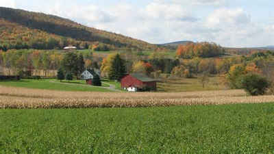
high altitude and originally heavily forested, Wayne yielded lumber which was
floated down the Delaware. This was the first industry. The county was soon
found to be good for grazing livestock. Originally not thought to have any coal
itself, Wayne profited from being on the route of the coal carrying Delaware and
Hudson Canal and its railroad extension from Honesdale to Carbondale. Philip
Hone from New York was an early developer. In 1829 the first locomotive to run
in North America, the "Stourbridge Lion," ran in Wayne County. Christian
Dorflinger came from New York to White Mills in 1865 and built a glassmaking
complex. He died in 1915, and his factory closed in 1921. Dairy farming and
poultry are important but have declined since 1980. Farms today occupy 30
percent of the land. The county includes the very northeastern tip of the
Northern Anthracite field. Mining was profitable from the late nineteenth
century until about 1946. Sharing with Pike and Monroe Counties the phenomenal
residential growth, produced by immigrants from New York and New Jersey arriving
since 1975, the county's economy is now shifted toward tourism, health services,
and home construction. Many new dwellings have gone up, mostly outside the old
community centers.
Geography: Land and Water
As reported by the Census Bureau, the county has a total area of 751 square miles (1,944 km2), of which, 729
square miles (1,889 km2) of it is land and 21 square miles (55 km2) of it (2.84%) is water.
The terrain of the county is varied. In the wider northern half, it is rugged along its borders; with higher hills
found along the western border, lower ones in the east near the river and a wide plain in the middle. The southern
portion tends to be swampier.
The highest elevation in the county, 2,656 feet (809.5 m), is the summit of Mount Ararat in Preston Township, near
Orson. Two other summits at the north end of the same ridge also exceed 2,640 feet (804.6 m) elevation. The lowest
point is along the Delaware River at the Pike County line, approximately 680 feet (207.2 m).
Most of the county is drained by the Delaware River (which separates it from New York,) except for small western
areas drained by the Starrucca Creek and the Lackawanna River into the Susquehanna River.
Neighboring Counties
Bordering counties are as follows:
- Broome County, New York (north)
- Delaware County, New York (northeast)
- Sullivan County, New York (east)
- Pike County (south)
- Monroe County (south)
- Lackawanna County (west)
- Susquehanna County (west)
Education
Public school districts
Forest City Regional (also in Lackawanna and Susquehanna)
North Pocono (also in Lackawanna)
Susquehanna Community (also in Susquehanna)
Wallenpaupack Area (also in Pike)
Wayne Highlands
Western Wayne


Click Image to Enlarge
