

Click Image to Enlarge
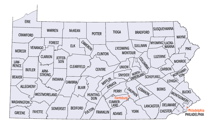
Pennsylvania Counties
There are sixty-seven counties of the Commonwealth of Pennsylvania in the United States of America. The city of Philadelphia is coterminous with Philadelphia County, and governmental functions have been consolidated since 1854.Westmoreland County, Pennsylvania
Westmoreland County Education, Geography, and History
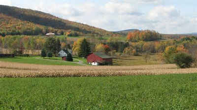
Westmoreland County is a county located in the state of Pennsylvania. Based on the 2010 census, the population was 365,169. The county seat
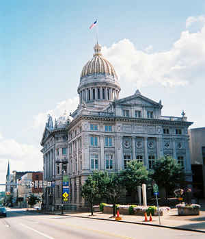
is Greensburg. Cut from Lancaster, Northumberland, and later Bedford Counties, Westmoreland County was founded on February 26, 1773 and was
the first county in the colony of Pennsylvania in which its entire territorial boundary was located west of the Allegheny Mountains.
Westmoreland County originally included the present-day counties of Fayette, Washington, Greene, and parts of Beaver, Allegheny, Indiana, and
Armstrong counties. It is named for Westmorland, an historic county of England.
Westmoreland County is included in the Pittsburgh, PA Metropolitan Statistical Area.
Etymology - Origin of Westmoreland County Name
Named for a county in England. Greensburg
Demographics:
County QuickFacts: CensusBureau Quick Facts
Westmoreland County History
Created on February 26, 1773, from
part of Bedford County and named for a county in England. Greensburg, the county
seat after 1785, was incorporated as a borough on February 9, 1799 and as a city
in 1928. It was named for General Nathanael Greene. The British and Indians
burned Hannastown, the original county seat on July 13, 1782.
Ligonier and Bushy Run were posts licensed by the British Army in 1758, along
the Forbes Road, before the full county area was acquired by Pennsylvania from
the Indians in the New Purchase in 1768. At Bushy Run, in 1763, one of the few
field engagements against Indians resulted in a British and colonial victory.
Robert Hanna and Arthur St. Clair led the move to erect a Pennsylvania county to
thwart the extension of Virginia's political control of the area. Rivalry with
Virginia became violent in 1774-1775, but Virginia finally yielded its claim in
1779. This area was also involved in Dunmore's War and in Indian fighting during
the Revolution. Hannastown, burnt by Indians in 1782, was not rebuilt because
Greensburg was growing rapidly. The county's location on both the Forbes and
Braddock Roads was vital to the rise of Pittsburgh. Railroads later followed,
using approximately the same routes. Railroad yards grew at Monessen and
Latrobe. Greensburg and Ligonier were farm products centers. The Connellsville
Coke region, opened in the 1840s, led to the rise of Mount Pleasant and
Scottdale. The valuable Pittsburgh Vein bituminous underlay the county. After
coke making developed, there were booms in iron, steel, tinplate, aluminum,
manufactured metal items, and glass. Silk, wool, paper, and rubber products
followed. Natural gas was used by many industries. Ligonier continued to be a
center for dairying and flour; auto parts were produced in Mount Pleasant, and
tires in Jeannette. Since the 1960s, deindustrialization has been acute in the
steel, aluminum, tinplating, and coke sectors. The peak of coal production
occurred from 1925 to 1945; the county now is a minor coal producer from surface
mines. In 1920 agriculture cash receipts were 11th in the state, and among these
grain production was 8th in the state. Grain production was greatly reduced
after WWII. In 1989, the county's farms are about 26th in total receipts among
Pennsylvania counties, with strong meat, dairying, and mushroom production. Many
small farms cover one-fourth of the land, and the county is a leader in eggs,
oats, and alfalfa. Today, some steel is still produced and glass and metal
products are important, but retail establishments are especially strong. Many
residents are Pittsburgh workers.
Geography: Land and Water
As reported by the Census Bureau, the county has a total area of 1,036 square miles (2,684 km2), of which,
1,025 square miles (2,656 km2) of it is land and 11 square miles (28 km2) of it (1.05%) is water.
Neighboring Counties
Bordering counties are as follows:
- Armstrong County (north)
- Indiana County (northeast)
- Cambria County (east)
- Somerset County (southeast)
- Fayette County (south)
- Washington County (southwest)
- Allegheny County (west)
- Butler County (northwest)
Education
Public school districts
Belle Vernon Area School District (Also in Fayette County)
Blairsville-Saltsburg School District (Also in Indiana County)
Burrell School District
Derry Area School District
Franklin Regional School District
Greater Latrobe School District
Greensburg-Salem School District
Hempfield Area School District
Jeannette City School District
Kiski Area School District (Also in Armstrong County)
Leechburg Area School District (Also in Armstrong County)
Ligonier Valley School District
Monessen City School District
Mount Pleasant Area School District
New Kensington–Arnold School District
Norwin School District
Penn-Trafford School District (also in Allegheny County)
Southmoreland School District (also in Fayette County)
Yough School District
Colleges and universities
Penn State New Kensington
Seton Hill University
Saint Vincent College
Westmoreland County Community College
University of Pittsburgh at Greensburg
Carlow College at Greensburg


Click Image to Enlarge
