


Click Image to Enlarge
South Carolina Counties
South Carolina is made up of fourty-six counties. They range in size from 392 square miles (1,016 square kilometers) in the case of Calhoun County to 1,358 square miles (3,517 square kilometers) in the case of Charleston County. The least populous county is McCormick County, with only 9,958 residents, while the most populous county is Greenville County, with a population of 395,357, despite the state's most populous city, Columbia, being located in Richland County.Abbeville County, South Carolina
Abbeville County Education, Geography, and History
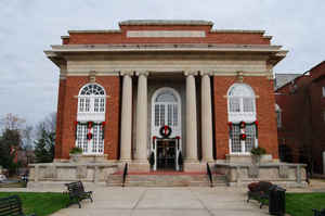
Abbeville County is a county located in the state of South Carolina. Based on the 2010 census, its population was 25,417. Its county seat
is Abbeville. It is the first county in the United States alphabetically.
Abbeville County is included in the Greenwood, SC Micropolitan Statistical Area, which is also included in the
Greenville-Spartanburg-Anderson, SC Combined Statistical Area.
Etymology - Origin of Abbeville County Name
Both the county and its county seat, the town of Abbeville, were named for the French town of the same name.
Demographics:
County QuickFacts: CensusBureau Quick Facts
Abbeville County History
Both the county and its county seat, the town of Abbeville, were named for the French town of the same name. Originally part of Ninety-Six District, the area was designated as Abbeville County in 1785. Parts of Abbeville later went to form Greenwood (1897) and McCormick (1916) counties. The county was settled primarily by Scotch-Irish and French Huguenot farmers in the mid-eighteenth century. A historic treaty with the Cherokee Indians was signed at Dewitt's Corner (now Due West) in 1777. Abbeville was known as a hotbed of secession, and at the end of the Civil War the last Confederate council of war was held there. Abbeville's most famous native son was John C. Calhoun (1782-1850), United States vice president, secretary of war and of state, and senator.
Geography: Land and Water
The county seat of Abbeville County is Abbeville, SC. As reported by the Census Bureau, the county has a total
area of 511 square miles (1,324 km2), of which, 508 square miles (1,316 km2) of it is land and 3 square miles (8
km2) of it (0.59%) is water.
Neighboring Counties
Bordering counties are as follows:
- Greenville County, South Carolina - north
- Anderson County, South Carolina - north
- Laurens County, South Carolina - northeast
- Greenwood County, South Carolina - east
- McCormick County, South Carolina - southeast
- Elbert County, Georgia - west
Education
Unified school districts
All of Abbeville County schools fall into one district.
Other school districts
Calhoun Falls Charter School (this school is a part of the South Carolina Public Charter School district, but still associates itself with the Abbeville County School district)
Colleges and universities
Erskine College, a four-year Christian liberal arts college, with 575 undergraduates, is located in Due West, South Carolina
Piedmont Technical College, in Abbeville, SC


Click Image to Enlarge
