


Click Image to Enlarge
South Carolina Counties
South Carolina is made up of fourty-six counties. They range in size from 392 square miles (1,016 square kilometers) in the case of Calhoun County to 1,358 square miles (3,517 square kilometers) in the case of Charleston County. The least populous county is McCormick County, with only 9,958 residents, while the most populous county is Greenville County, with a population of 395,357, despite the state's most populous city, Columbia, being located in Richland County.Calhoun County, South Carolina
Calhoun County Education, Geography, and History
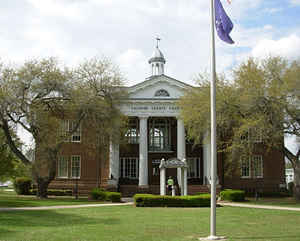
Calhoun County is a county in the state of South Carolina. Based on the 2010 census, its population was 15,175, making it the third-least
populous county in South Carolina. Its county seat is St. Matthews. The county was formed in 1908 from portions of Lexington and Orangeburg
Counties and is named for John C. Calhoun, the former US Vice-President, Senator, Representative and cabinet member from South Carolina.
Calhoun County is part of the Columbia, SC Metropolitan Statistical Area.
Etymology - Origin of Calhoun County Name
Calhoun County was named for John C. Calhoun (1782-1850), who served as United States vice president, secretary of state and of war, and senator.
Demographics:
County QuickFacts: CensusBureau Quick Facts
Calhoun County History
Calhoun County was named for John C. Calhoun (1782-1850), who served as United States vice president, secretary of state and of war, and senator. The county seat, the town of St. Matthews, was settled around 1841 in an area that was known for its cotton plantations. The county itself was formed in 1908 from parts of Orangeburg and Lexington counties. During the Revolutionary War a famous incident took place at Fort Motte in present day Calhoun County. Rebecca Motte(1738-1815), a local plantation owner, helped the Revolutionary troops drive the British out of her plantation house; she reportedly provided the soldiers with a burning arrow to destroy her own dwelling. Another famous resident of the area was Pulitzer Prize-winning writer Julia Peterkin (1880-1961), who lived at Lang Syne Plantation.
Geography: Land and Water
As reported by the Census Bureau, the county has a total area of 392 square miles (1,016 km2), of which, 380 square miles (985 km2) of it is land and 12 square miles (31 km2) of it (3.09%) is water.
Neighboring Counties
Bordering counties are as follows:
- Richland County - north
- Sumter County - northeast
- Clarendon County - east
- Orangeburg County - south
- Lexington County - northwest
Education


Click Image to Enlarge
