


Click Image to Enlarge
South Carolina Counties
South Carolina is made up of fourty-six counties. They range in size from 392 square miles (1,016 square kilometers) in the case of Calhoun County to 1,358 square miles (3,517 square kilometers) in the case of Charleston County. The least populous county is McCormick County, with only 9,958 residents, while the most populous county is Greenville County, with a population of 395,357, despite the state's most populous city, Columbia, being located in Richland County.Colleton County, South Carolina
Colleton County Education, Geography, and History
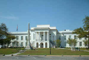
Colleton County is a county located in the Lowcountry region of the state of South Carolina. Based on the 2010 census, its population was 38,892. Its county seat is Walterboro. The county is named after Sir John Colleton, 1st Baronet, one of the eight Lords Proprietor of the Province of Carolina. After two previous incarnations, the current Colleton County was created in 1800
Etymology - Origin of Colleton County Name
Colleton is named after John Colleton, one of the Lords Proprietors of the Province of Carolina.
Demographics:
County QuickFacts: CensusBureau Quick Facts
Colleton County History
Colleton County was named for one of the Lords Proprietors, Sir John Colleton (1608-1666). The county was first created in 1682 under the proprietary government, but the designation was seldom used in the colonial period. Instead, the area was known by its parish names: St. Bartholomew, St. Paul, and St. George Dorchester. In 1769 these parishes became part of Charleston District, where they remained until Colleton District was formed in 1800. A portion of the county was removed in 1897 to form Dorchester County. Several Revolutionary War skirmishes took place in Colleton County, and the state legislature met in the town of Jacksonboro in 1782 while Charleston was occupied by the British. This part of the lowcountry was known for its extensive rice and cotton plantations, many of which were bought by Northerners after the Civil War for use as hunting preserves; some of those lands are now being incorporated into the ACE Basin, a nature preserve bounded by the Ashepoo, Combahee, and Edisto rivers. The Revolutionary War hero Isaac Hayne (1745-1781) was a Colleton resident, as were politicians Rawlins Lowndes (1721-1800) and William Lowndes (1782-1822).
Geography: Land and Water
As reported by the Census Bureau, the county has a total area of 1,133 square miles (2,935 km2), of which,
1,056 square miles (2,736 km2) of it is land and 77 square miles (199 km2) of it (6.78%) is water.
Neighboring Counties
Bordering counties are as follows:
- Orangeburg County, South Carolina - north
- Dorchester County, South Carolina - northeast
- Charleston County, South Carolina - east
- Beaufort County, South Carolina - south
- Hampton County, South Carolina - west
- Allendale County, South Carolina - west
- Bamberg County, South Carolina - northwest
Education


Click Image to Enlarge
