


Click Image to Enlarge
South Carolina Counties
South Carolina is made up of fourty-six counties. They range in size from 392 square miles (1,016 square kilometers) in the case of Calhoun County to 1,358 square miles (3,517 square kilometers) in the case of Charleston County. The least populous county is McCormick County, with only 9,958 residents, while the most populous county is Greenville County, with a population of 395,357, despite the state's most populous city, Columbia, being located in Richland County.Lancaster County, South Carolina
Lancaster County Education, Geography, and History
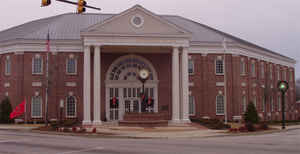
Lancaster County is a county located in the state of South Carolina. Based on the 2014 census, its population was 83,180. Its
county seat is Lancaster which has an urban population of 23,979. The county was created in 1785.
Lancaster County is included in the Charlotte-Concord-Gastonia, NC-SC Metropolitan Statistical Area. It is located in the Piedmont region.
Etymology - Origin of Lancaster County Name
Lancaster is named for Lancaster County, Pennsylvania.
Demographics:
County QuickFacts: CensusBureau Quick Facts
Lancaster County History
Many of the early settlers came to South Carolina from Lancaster, Pennsylvania. They had named their county for their
home in England, the region of the House of Lancaster which had opposed the House of York in the struggles of 1455-85,
known as the War of the Roses. The House of Lancaster chose the red rose as their emblem while their neighbor, York
County, boasts the white rose.
The Catawba Indians claimed all the present Lancaster County when the first pioneers came in the early 1750s and settled
between Rum Creek and Twelve Mile Creek. Waxhaw Creek within this area had taken its name from the Waxhaw Indian tribe.
The majority of the new settlers were Scots-Irish from Pennsylvania; others from North Carolina and Virginia joined
them. A second settlement was made in the lower part of the present Lancaster County on Hanging Rock Creek. The first
grant was made there in 1752, and included the huge overhanging mass of rock from which the creek takes its name. About
the time this section was opened up, others came in and settled along Lynches Creek, Little Lynches creek, Flat Creek,
Beaver Creek, and lower Camp Creek. In coming to the Lancaster area, the first settlers had to follow old Indian paths,
which became traveled so frequently, they were coming to be known as roads.
The Rocky River Road is an old route that originated as an Indian path. Along there in the American Revolutionary War,
Colonel Abraham Buford fled from Tarleton and was overtaken a few miles south of the N.C. state line where the Patriot
forces were defeated in a controversial struggle known as the Battle of Hanging Rock, also known as Bufords Massacre to
locals. Today, the Rocky River Road is part of South Carolina Highway 522, the latter following the old thoroughfare
very closely.
Lancaster County and its county seat were named for Lancaster County, Pennsylvania. The county was formed in 1785, and
it was originally part of Camden District. A part of Lancaster County was removed in 1791 to form Kershaw County.
Scotch-Irish settlers from Pennsylvania began moving into this upstate region in the 1750s. The Waxhaws settlement on
the border with North Carolina was the birthplace of President Andrew Jackson (1767-1845). During the Revolutionary War
British Lt. Col. Banastre Tarleton earned his nickname of "Bloody" Tarleton by massacring American troops in this area
on May 29, 1780; the Battle of Hanging Rock was also fought in the county later the same year. Although Lancaster County
has been primarily agricultural, gold mining began there in the 1820s and textile manufacturing sprang up following the
Civil War. Governor and US Senator Stephen Decatur Miller (1787-1838), surgeon J. Marion Sims (1813-1883),
industrialist Elliott White Springs (1896-1959), and astronaut Charles M. Duke, Jr. were all Lancaster County residents.
Geography: Land and Water
As reported by the Census Bureau, the county has a total area of 555 square miles (1,438 Square kilometres),
of which, 549 square miles (1,422 km2) of it is land and 6 square miles (16 km2) of it (1.13%) is water. It is bound
on the west by the Catawba River and Sugar Creek,and on the east by the Lynches River. It is located so that a 3
hour drive takes residents to either the mountains or the oceanside.
Neighboring Counties
Bordering counties are as follows:
- Union County, North Carolina - north
- Chesterfield County, South Carolina - east
- Kershaw County, South Carolina - south
- Fairfield County, South Carolina - southwest
- York County, South Carolina - west
- Chester County, South Carolina - west
- Mecklenburg County, North Carolina - northwest
Education


Click Image to Enlarge
