


Click Image to Enlarge
South Carolina Counties
South Carolina is made up of fourty-six counties. They range in size from 392 square miles (1,016 square kilometers) in the case of Calhoun County to 1,358 square miles (3,517 square kilometers) in the case of Charleston County. The least populous county is McCormick County, with only 9,958 residents, while the most populous county is Greenville County, with a population of 395,357, despite the state's most populous city, Columbia, being located in Richland County.Laurens County, South Carolina
Laurens County Education, Geography, and History
Laurens County is a county located in the state of South Carolina. Based on the 2010 census, its population was 66,537. Its county seat is
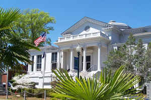
Laurens.
Laurens County is included in the Greenville-Anderson-Mauldin, SC Metropolitan Statistical Area.
Etymology - Origin of Laurens County Name
Laurens is named for president of the Continental Congress Henry Laurens.
Demographics:
County QuickFacts: CensusBureau Quick Facts
Laurens County History
Laurens County and its county seat were named for Revolutionary War leader Henry Laurens (1724-1792). The county was established in 1785 as a part of Ninety Six District. This part of the state was settled primarily by Scotch-Irish and English immigrants in the mid 1700s, and during the American Revolution quite a few of its residents remained loyal to Great Britain. Several Revolutionary War battles were fought in the county, including the Battle of Musgrove's Mill (August 18, 1780). President Andrew Johnson (1808-1875), a native of North Carolina, worked as a tailor in the town of Laurens for a brief time in the 1820s. Laurens County was also home to Ann Pamela Cunningham (1816-1875), the leader of the movement to preserve Mount Vernon, and educator Wil Lou Gray (1883-1984).
Geography: Land and Water
As reported by the Census Bureau, the county has a total area of 724 square miles (1,875 km2), of which, 715 square miles (1,852 km2) of it is land and 9 square miles (23 km2) of it (1.23%) is water.
Neighboring Counties
Bordering counties are as follows:
- Spartanburg County, South Carolina - north
- Union County, South Carolina - northeast
- Newberry County, South Carolina - southeast
- Greenwood County, South Carolina - south
- Abbeville County, South Carolina - southwest
- Anderson County, South Carolina - west
- Greenville County, South Carolina - northwest
Education
There are three public school districts in the county. Laurens County District 55 covers what is generally the northeastern half of the
county while District 56 covers the southwestern half. The Ware Shoals area is covered by the multi-county Greenwood County District 51. There
are two public high schools in the county: Laurens (in Dist. 55) and Clinton (in Dist. 56.)
Public K-12 education includes Hickory Tavern Elementary, Ford Elementary, Gray Court-Owings, Pleasant View Elementary, E.B. Morse, Hickory
Tavern Middle, Laurens Middle, and Sanders Middle.
Private K-12 education includes Laurens Academy.
Presbyterian College, located in Clinton, is a four year liberal-arts school founded in 1880.


Click Image to Enlarge
