


Click Image to Enlarge
South Carolina Counties
South Carolina is made up of fourty-six counties. They range in size from 392 square miles (1,016 square kilometers) in the case of Calhoun County to 1,358 square miles (3,517 square kilometers) in the case of Charleston County. The least populous county is McCormick County, with only 9,958 residents, while the most populous county is Greenville County, with a population of 395,357, despite the state's most populous city, Columbia, being located in Richland County.Pickens County, South Carolina
Pickens County Education, Geography, and History
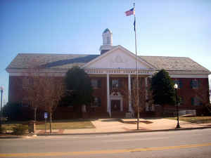
Pickens County is a county located in the state of South Carolina. Based on the 2010 census, its population was 119,224. Its county seat is
Pickens. The county was created in 1826.
It is part of the Greenville-Anderson-Mauldin, SC Metropolitan Statistical Area.
Etymology - Origin of Pickens County Name
Pickens is named for US Representative Andrew Pickens.
Demographics:
County QuickFacts: CensusBureau Quick Facts
Pickens County History
Pickens County was named for Revolutionary War hero Andrew Pickens (1739-1817). This area in the northwestern corner of the state was Indian territory until 1777. It subsequently became part of Pendleton District (at one time called Washington District). In 1826 Pendleton was divided into two counties, Pickens and Anderson; the western portion of Pickens County was later split off to form Oconee County (1868). The earliest European settlers in this region were Indian traders. The British built Fort Prince George around 1753 as protection against the Indians, and the fort was the site of several battles in the Cherokee War of 1756. The Cherokee town of Old Seneca was later destroyed by American troops in 1776. John C. Calhoun (1782-1850), US Vice President, Senator, and cabinet member, made his home at Fort Hill plantation in Pickens County. His son-in-law, Thomas Green Clemson (1807-1888), bequeathed the plantation to the state for use as an agricultural college, which led to the founding of Clemson University.
Geography: Land and Water
As reported by the Census Bureau, the county has a total area of 512 square miles (1,326 km2), of which, 497
square miles (1,287 km2) of it is land and 15 square miles (39 km2) of it (2.92%) is water.
Neighboring Counties
Bordering counties are as follows:
- Transylvania County, North Carolina - north
- Greenville County, South Carolina - east
- Anderson County, South Carolina - south
- Oconee County, South Carolina - west
Education
Colleges and universities
Clemson University
Southern Wesleyan University


Click Image to Enlarge
