


Click Image to Enlarge
South Carolina Counties
South Carolina is made up of fourty-six counties. They range in size from 392 square miles (1,016 square kilometers) in the case of Calhoun County to 1,358 square miles (3,517 square kilometers) in the case of Charleston County. The least populous county is McCormick County, with only 9,958 residents, while the most populous county is Greenville County, with a population of 395,357, despite the state's most populous city, Columbia, being located in Richland County.Sumter County, South Carolina
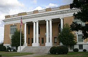
Sumter County Education, Geography, and History
Sumter County is a county located in the state of South Carolina. Based on the 2010 census, the population was 107,456; in a 2013 census
estimate, the population was at 108,123. Its county seat is Sumter. The county was created in 1800.
Sumter County comprises the Sumter, South Carolina Metropolitan Statistical Area.
Etymology - Origin of Sumter County Name
Sumter is named for Thomas Sumter, a Continental leader during the American Revolutionary War.
Demographics:
County QuickFacts: CensusBureau Quick Facts
Sumter County History
Sumter County and its county seat were named for Revolutionary War General Thomas Sumter (1734-1832), who was a resident of the area. This county has changed its name and boundaries several times. In 1785 Claremont County was formed as a part of Camden District; a part of the county was later split off in 1791 to form Salem County. Claremont, Clarendon, and Salem counties were combined into Sumter District in 1800. Clarendon was once again split off in 1857, however, and another small part of Sumter County went to form Lee County in 1902. This part of the state began attracting English settlers from the lowcountry and from Virginia in the mid-eighteenth century. The area known as the High Hills of Santee, a narrow ridge along the Wateree River, was famous for its healthy climate and rich soil. Sumter County eventually became a leading agricultural region. In 1941, Shaw Air Force Base was established near Sumter, and it continues today as an active duty fighter base. Confederate General Richard Heron Anderson (1821-1879) was a Sumter resident, as were opera singer Clara Louise Kellogg (1842-1916) and educator Mary McLeod Bethune (1875-1955).
Geography: Land and Water
As reported by the Census Bureau, the county has a total area of 682 square miles (1,766 km2), of which, 665
square miles (1,723 km2) of it is land and 17 square miles (43 km2) of it (2.44%) is water.
Neighboring Counties
Bordering counties are as follows:
- Lee County, South Carolina - north
- Florence County, South Carolina - northeast
- Clarendon County, South Carolina - south
- Calhoun County, South Carolina - southwest
- Richland County, South Carolina - west
- Kershaw County, South Carolina - northwest
Education


Click Image to Enlarge
