


Click Image to Enlarge
Tennessee Counties
There are ninety-five counties in the State of Tennessee. The oldest county is Washington County, founded in 1777. The most recently formed county is Chester County (1879)Campbell County, Tennessee
Campbell County Education, Geography, and History
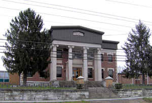
Campbell County is a county located in the state of Tennessee. Based on the 2010 census, the population was 40,716. Its county seat is
Jacksboro.
Campbell County is included in the Knoxville, TN Metropolitan Statistical Area.
Etymology - Origin of Campbell County Name
Virginia House of Burgesses member Arthur Campbell (1743–1811), who was a negotiator of Indian treaties, and an officer during the American Revolutionary War.
Demographics:
County QuickFacts: CensusBureau Quick Facts
History of Campbell County
Campbell County was formed in 1806 from parts of Anderson and Claiborne counties. It was named in honor of Colonel Arthur Campbell
(1743–1811), a member of the Virginia House of Burgesses and an officer during the American Revolutionary War.
During the Civil War, the county's sympathies were predominantly with the Union. On June 8, 1861, Campbell Countians rejected Tennessee's
Ordinance of Secession by a vote of 1,094 to 60. On August 1, 1861, Campbell County became the first Tennessee county to form a Union Army
unit for the Civil War, organizing Company B of the 1st Tennessee Infantry at Jacksboro
Tennessee Encyclopedia of History and Culture
The Tennessee General Assembly created Campbell County on September 11, 1806,
from land taken from Anderson and Claiborne Counties. The twenty-sixth county
was named in honor of Colonel Arthur Campbel..Find more from the Tennessee Encyclopedia of History and Culture:
CAMPBELL COUNTY
Geography: Land and Water
As reported by the Census Bureau, the county has a total area of 498 square miles (1,290 km2), of which 480 square
miles (1,200 km2) is land and 18 square miles (47 km2) (3.6%) is water.
Campbell County is situated amidst a geological border region between the Cumberland Plateau in the northwest and the Appalachian
Ridge-and-Valley Range in the southeast. This border area is characterized by several large, elongate ridges, namely Cross Mountain in the
west and Cumberland Mountain, Walnut Mountain, and Pine Mountain to the north. Elevations vary widely across the county, ranging from 3,534
feet (1,077 m) at Cross Mountain to slightly less than 1,000 feet (300 m) a few miles away at Norris Lake. Norris Lake-- an artificial
reservoir created by the Tennessee Valley Authority in the 1930s-- is the main body of water in the region. It is fed by the Clinch and Powell
rivers as well as several large creeks, most notably Davis Creek, Big Creek, and Cove Creek. Cove Creek also feeds the much smaller Cove
Lake-- a recreational lake built by TVA in the 1930s as part of the Norris project-- which is located near Caryville.
Most of the county's residents live in the southern half of the county, where La Follette, Jacksboro, and Caryville are located. Jellico,
located along the Tennessee-Kentucky border, is the most notable populated area in the county's plateau section.
Portions of the county north of Walnut Mountain are part of the Cumberland River watershed. Portions of the county south of Walnut Mountain
are part of the Tennessee River watershed. In the northwestern part of the county a large valley, known as Elk Valley, runs from southwest to
northeast, from Pioneer to Jellico.
Neighboring Counties
Bordering counties are as follows:
- Whitley County, Kentucky (north)
- Claiborne County (east)
- Union County (southeast)
- Anderson County (south)
- Scott County (west)
- McCreary County, Kentucky (northwest)
Education


Click Image to Enlarge
