


Tennessee Geography: The Land
Geography and Landforms of Tennessee
 Find an overview of Tennessee
geography, topography, geographic land regions, land areas, and major rivers.
Find an overview of Tennessee
geography, topography, geographic land regions, land areas, and major rivers.
Access Tennessee almanac furnishing more details on the state geography, geographical and land regions, climate and weather, elevation, land areas, bordering states, and other statistical data.
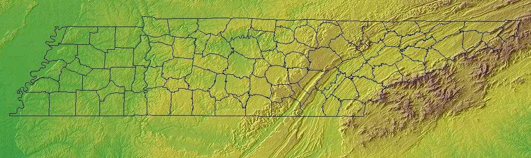
Stretching 440 miles from east to west, Tennessee
characterized by 6 main land regions; The Blue Ridge, the Appalachian Ridge and Valley Region, the Appalachian Plateau, the Highland Rim, the Nashville
Basin, and the Gulf Coastal Plain.
Tennessee Highest, Lowest, & Mean Elevations |
|
|---|---|
| Mean Elevation | 900 ft. |
| Highest Point | Clingmans Dome 6,643 ft. |
| Lowest Point | Mississippi River 178 ft. |
Tennessee Land Area (Square Miles) |
|
| Geographic Center | In Rutherford County, 5 mi. NE of Murfreesboro Longitude: 86° 37.3'W Latitude: 35° 47.7'N |
| Total Area | 42,143.27 sq. mi. 36th |
| Land Area | 41,217.12 sq. mi. |
| Water Area | 926.15 sq. mi. 2.19% |
| Forested Land Area | 51.6% |
| Dimensions (Length - Width) |
440 miles - 120 miles |
Tennessee: Physiographic Regions
Tennessee characterized by 6 main land regions;
- The Blue Ridge,
- the Appalachian Ridge and Valley Region,
- the Appalachian Plateau,
- the Highland Rim,
- the Nashville Basin, and the
- Gulf Coastal Plain.
Blue Ridge
On the border of North Carolina on the eastern edge of Tennessee is the Blue Ridge. High mountains in this area are The Great Smoky Mountains, the Chilhowee Mountains and the Snowbird Mountains. 5,000 feet above sea level is the average elevation of the Blue Ridge area. Clingman's Dome (6,643 feet above sea level) is the highest point in the state and is found in the Great Smoky Mountains.
Appalachian Ridge and Valley Region
Running west from the Blue Ridge for about 55 miles is the Appalachian Ridge and Valley Region. Fertile valleys separated by wooded ridges make up this area. The Great Valley where valleys become wider and the ridges are lower are also located in this region and are in the western section of the Appalachian Ridge and Valley Region.
Appalachian Plateau
Located to the west of the Appalachian Ridge and Valley Region is the Appalachian Plateau. It is also referred to as the Cumberland Plateau. It is covered with flat-topped mountains and is separated by sharp valleys. It rises from 1,500 feet to 1,800 feet above sea level. Southwest of Chattanooga and located in the southern part of the Appalachian Plateau is Lookout Mountain and provides views of seven states.
Highland Rim
Highland Rim lies west of the Appalachian Plateau. It is an elevated plain that surrounds the Nashville Basin. The Pennyroyal Region is located in the northern section of the Highland Rim.
Nashville Basin
The Nashville Basin, known for its rich, fertile farm country and is surrounded by the steep slopes of the Highland Rim.
Gulf Coastal Plain
The Gulf Coastal Plain lies west of the Highland Rim and Nashville Basin. It is the largest land region in terms of area in Tennessee. This area begins at the Gulf of Mexico and extends north into southern Illinois. The Gulf Coastal Plain (in Tennessee) is divided into three sections that extend from the Tennessee River, in the east, to the Mississippi River in the west. The western bank of the Tennessee River is hilly land that is the easternmost section. This section is only about 10 miles wide. An area called the Tennessee bottoms or the bottom land is to the west of this narrow strip of land. It is a wide area of rolling hills and streams that stretches all the way to Memphis in western Tennessee. The Tennessee Bottoms end in steep bluffs overlooking the Mississippi River in Memphis. The Mississippi Alluvial Plain (sometimes called The Delta Region) is to the west of the Tennessee Bottoms is less than 300 feet above sea level. This is an area of lowlands, flood plains and swamp land.
Tennessee Landscape and Landforms:
East Gulf Coastal Plain
The East Gulf Coastal Plain extends from the Florida Parishes of Louisiana over most of Mississippi, some of western Tennessee and Kentucky, the southwestern 2/3 of Alabama, and the western panhandle of Florida. Its southern boundary is the Gulf of Mexico and its western boundary the drop into the Mississippi Alluvial Valley. On the north it extends to the highlands of the Interior Low Plateaus and southern Appalachians. To the east, there is an arbitrary break with the South Atlantic Coastal Plain at the Alabama-Georgia border south through Florida along the Apalachicola River. The flat to rolling topography is broken by numerous streams and river bottoms. Uplands are dominated by pine, originally longleaf and slash in the south and shortleaf mixed with hardwoods in the north. These are fire-maintained systems that give way to loblolly pine and hardwoods in damper areas and bottomland hardwood forest in extensive lowland drainages.
Interior Low Plateaus
The Interior Low Plateaus constitute a diverse landscape that extends from north Alabama across central Tennessee and Kentucky into southern Illinois, Indiana, and Ohio. It consists of six distinct subregions: the Shawnee Hills, Bluegrass region, Western Highland Rim, Central Basin, Eastern Highland Rim, and Tennessee Valley. Its hilly topography sets it apart from the Coastal Plain to the south and Prairie Peninsula to the north. To the west, the valley of the Mississippi River separates the Interior Low Plateaus from the Ozark Highlands, the two of which share many similarities. Western mesophytic, oak-hickory, and beech-maple forests were historically the most abundant cover types. There were also tallgrass prairie elements in the north and northwest, oak savannahs in the Bluegrass and other northern sections, barrens and glades in central regions, and forested wetlands along major waterways
Mississippi Alluvial Valley
This area includes the floodplain of the Mississippi River that cuts into the Gulf Coastal Plain, extending north to and including the delta at the confluence of the Mississippi and Ohio Rivers and south toward the Gulf of Mexico. The Alluvial Valley includes most of eastern Louisiana, eastern Arkansas, northwest Mississippi, small portions of west Tennessee and Kentucky, the bootheel of Missouri, and the Cache River lowlands of Illinois. Nonforested marsh in southern portions of the floodplain is included in the Coastal Prairie physiographic area. Water shaped this land. The ridges and swales, levees, oxbows, and terraces of the Valley all resulted from meanderings and floods of the Mississippi River. Small changes in elevation determine how wet a site is, the plant community that grows there, and habitat conditions for birds.
Northern Cumberland Plateau
This is a largely forested, gently rolling tableland ranging from 300 m. To 580 m. in elevation. It is defined by the higher Eastern Highland Rim of the Interior Low Plateaus on the west and the Cumberland Mountains of the Ridge and Valley physiographic area on the east. The Cumberland Plateau extends south out of this physiographic area, where it is included with the Southern Ridge and Valley, and narrowly northward as well. As defined, the Northern Cumberland Plateau includes the eastern third of Kentucky, southwestern West Virginia, a small area in western Virginia, and a swath across Tennessee barely extending into Alabama and Georgia. Mixed mesophytic forest dominated by oaks, hickory, and, historically, American chestnut, is the most common cover type. Various pine species become more dominant on drier sites.
Southern Blue Ridge
The Southern Blue Ridge is an area of rugged mountains, long broad ridges, steep slopes, and deep ravines. It straddles the border between Tennessee and North Carolina, extending south into northeast South Carolina and northwest Georgia and north into Virginia. High Peaks spruce-fir forest grades at lower elevations into northern hardwood forest or hemlock-white pine forest on steep, north-facing slopes and Appalachian oaks on drier sites. The Appalachian oak type is the most widespread forest type in the area. Mixed mesophytic hardwood forests, also called cove forests, over on more mesic sites at low to mid-elevations. Various southern yellow pine mixes occur on dry ridges, often associated with a fire regime. There are also riparian forest types along valleys at various elevations, primarily in the lowlands. Disturbance, including fire, grazing, and storm damage, plays a major role in determining the distribution and successional status of many of these forest types.
Southern Ridge and Valley
This physiographic area consists of both the Southern end of the Ridge and Valley system as well as the tablelands of the Southern Cumberland Plateau. It descends to the Coastal Plain to the south and rises to the Blue Ridge to the east. It is located in eastern Tennessee, northwest Georgia, and northeast Alabama, and is arbitrarily separated from the Mid-Atlantic Ridge and Valley at the Tennessee-Virginia border. Upland deciduous forest, the most common naturally-occurring cover type, is predominantly mixed mesophytic, oak-hickory, or oak-pine forest. There is also a considerable area dominated by pine, either shortleaf or loblolly.

