


Click Image to Enlarge
Tennessee Counties
There are ninety-five counties in the State of Tennessee. The oldest county is Washington County, founded in 1777. The most recently formed county is Chester County (1879)Carroll County, Tennessee
Carroll County Education, Geography, and History
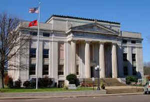
Carroll County is a county located in the state of Tennessee. Based on the 2010 census, the population was 28,522. Its county seat is Huntingdon. The county was named for Governor William Carroll.
Etymology - Origin of Carroll County Name
Named in honor of William Carroll (1788-1844), colonel and major-general in the War of 1812, governor of Tennessee for six terms, known as Tennessee's "reform governor."
Demographics:
County QuickFacts: CensusBureau Quick Facts
History of Carroll County
Created 1821 from Indian lands; named in honor of William Carroll (1788-1844), colonel and major-general in the War of 1812, governor of Tennessee for six terms, known as Tennessee's "reform governor."
Carroll County was formed in 1821 from Indian lands (Public Acts of Tennessee 1821, Chapter 32).
Tennessee Encyclopedia of History and Culture
The Tennessee General Assembly created Carroll County on November 7, 1821, and named it for the governor, William
Carroll. The area from which the county was taken had been part of the Western District, which was controlled by the
Chickasaws until ceded in the Jackson Purchase of 1818. Settlers began to move into the area in 1820, where they
found abundant game, fertile land, and large forests. Grass-covered areas known as "barrens" provided pasturage for
livestock and easy cultivation. Realizing that the temperate climate and natural resources offered a bright future,
the settlers established firm roots in the county and founded a number of communities and towns that continue today,
including McKenzie, Trezevant, Bruceton, Atwood, McLemoresville, Clarksburg, and Huntingdon. Find more from the Tennessee Encyclopedia of History and Culture:
CARROLL COUNTY
Geography: Land and Water
As reported by the Census Bureau, the county has a total area of 600 square miles (1,554 km2), of which, 599
square miles (1,551 km2) of it is land and 1 square miles (2 km2) of it (0.14%) is water.
Neighboring Counties
Bordering counties are as follows:
- Henry County (north)
- Benton County (east)
- Decatur County (southeast)
- Henderson County (south)
- Madison County (southwest)
- Gibson County (west)
- Weakley County (northwest)
Education


Click Image to Enlarge
