


Click Image to Enlarge
Tennessee Counties
There are ninety-five counties in the State of Tennessee. The oldest county is Washington County, founded in 1777. The most recently formed county is Chester County (1879)Decatur County, Tennessee
Decatur County Education, Geography, and History
Decatur County is a county located in the state of Tennessee. Based on the 2010 census, the population was 11,757. The county was created in November 1845 from the part of Perry County west of the Tennessee River in response to a petition by citizens on the west side of the river who lacked easy access to the county seat, which was located on the east side of the river. Its county seat is Decaturville
Etymology - Origin of Decatur County Name
Named in honor of Stephen Decatur (1779-1820), American naval officer who won fame in the War with Tripoli in 1804, in the War of 1812, and in the Algerine War in 1815 for his daring exploits.
Demographics:
County QuickFacts: CensusBureau Quick Facts
History of Decatur County
Created 1845 from Perry County; named in honor of Stephen Decatur (1779-1820), American naval officer who won fame in the War with Tripoli in 1804, in the War of 1812, and in the Algerine War in 1815 for his daring exploits.
Decatur County was formed in 1845 from Perry County (Acts of Tennessee 1845-46, Chapter 7).
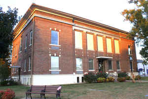
There were fires at the Decatur County courthouse in 1869 and 1927.
Tennessee Encyclopedia of History and Culture
Decatur County borders the Tennessee River in West Tennessee and was established in 1845. Its name honors
Commodore Stephen Decatur, naval hero of the War of 1812. Carved from land originally claimed by the Chickasaws, the
area was part of the Jackson Purchase of 1818. Decatur County was initially part of Perry County, which is on the
east shore of the river, but citizens on the western side petitioned the general assembly for a new county in 1845.
In 1849 Decatur County gained an additional three-mile strip from Hardin County, making its total area 346 square
miles. According to the 2000 census, 11,731 people live in the county.
Largely rural in nature, Decatur County contains several small towns and communities. Decaturville, established in
1847 near the center of the county, serves as the county seat. The county's largest town, Parsons, like many
nineteenth-century communities in West Tennessee, developed around newly laid railroad tracks. In 1889 local
entrepreneur Henry Myracle encouraged area settlement by donating 143 acres to the Tennessee Midland Railroad
Company. Initially called Parsons Flat after Myracle's son-in-law Dock Parsons, the town gained its charter in 1913.
More at Tennessee Encyclopedia of History and Culture:
DECATUR COUNTY
Geography: Land and Water
As reported by the Census Bureau, the county has a total area of 345 square miles (893 km2), of which, 334
square miles (865 km2) of it is land and 11 square miles (29 km2) of it (3.19%) is water.
Neighboring Counties
Bordering counties are as follows:
- Benton County (north)
- Perry County (east)
- Wayne County (southeast)
- Hardin County (south)
- Henderson County (west)
- Carroll County (northwest)
Education


Click Image to Enlarge
