


Click Image to Enlarge
Tennessee Counties
There are ninety-five counties in the State of Tennessee. The oldest county is Washington County, founded in 1777. The most recently formed county is Chester County (1879)Humphreys County, Tennessee
Humphreys County Education, Geography, and History
Humphreys County is a county located in the state of Tennessee. Based on the 2010 census, the population was 18,538. Its county seat is Waverly.
Etymology - Origin of Humphreys County Name
Named in honor of Parry Wayne Humphreys (1778-1839), judge of the Superior Court of Tennessee, US representative from Tennessee, and longtime judge of the state judicial district.
Demographics:
County QuickFacts: CensusBureau Quick Facts
History of Humphreys County
Created 1809 from Stewart County; named in honor of Parry Wayne Humphreys (1778-1839), judge of the Superior Court of Tennessee, US representative from Tennessee, and longtime judge of the state judicial district.
Humphreys County was formed in 1809 from Stewart County
(Acts of Tennessee 1809, Chapter 31).
Tennessee Encyclopedia of History and Culture
Situated next to the Tennessee River on the western edge of Middle Tennessee, Humphreys County has a history
intimately linked to its location and natural resources. It contains fertile agricultural land along its major
waterways--the Tennessee, Duck, and Buffalo Rivers--and in the creek-lined lands of its innumerable rolling hills. A
strong agricultural tradition and proximity to the Tennessee River have been the county's mainstay since its 1809
creation from parts of Stewart County.
Prior to white settlement Native Americans lived and hunted on the land that eventually became Humphreys County. Of
these indigenous groups, Woodland and Mississippian groups left the most visible remains. Many mound sites are
located in the western section of the county, with the most prominent being the Link and Slayden sites situated near
Hurricane Mills on the Duck River. Partially excavated in 1936 by the Works Progress Administration, the Slayden
site revealed a small circular village with two community houses and a nearby cemetery. The Link site contained six
mounds and several cemeteries.
In 1811 the county established its first seat, Reynoldsburg, on the Tennessee River, where a stage line to Nashville
crossed. Reynoldsburg thrived as an important transportation center until 1835, when the county was divided and
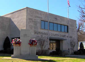
Waverly became the new county seat. Selected for its central location and access to the stage line, by 1838 Waverly
included a courthouse, jail, businesses, and many log dwellings. Find more from the Tennessee Encyclopedia of History and Culture:
HUMPHREYS COUNTY
Geography: Land and Water
As reported by the Census Bureau, the county has a total area of 556.72 square miles (1,441.90 km2), of which,
532.22 square miles (1,378.44 km2) of it is land and 24.5 square miles (63.5 km2) of it (4.40%) is water.
Neighboring Counties
Bordering counties are as follows:
- Houston County (north)
- Dickson County (northeast)
- Hickman County (southeast)
- Perry County (south)
- Benton County (west)
Education


Click Image to Enlarge
