


Click Image to Enlarge
Tennessee Counties
There are ninety-five counties in the State of Tennessee. The oldest county is Washington County, founded in 1777. The most recently formed county is Chester County (1879)McNairy County, Tennessee
McNairy County Education, Geography, and History
McNairy County is a county located in the state of Tennessee. Based on the 2010 census, the population was 26,075. Its county seat is Selmer. McNairy County is located along Tennessee's border with the state of Mississippi.
Etymology - Origin of McNairy County Name
Named in honor of John McNairy (1762-1837), North Carolina Superior Court judge for Mero District, 1796 Constitutional Convention delegate, US district judge for Tennessee, Davidson Academy trustee.
Demographics:
County QuickFacts: CensusBureau Quick Facts
History of McNairy County
Created 1823 from Hardin County; named in honor of John McNairy (1762-1837), North Carolina Superior Court judge for Mero District, 1796 Constitutional Convention delegate, US district judge for Tennessee, Davidson Academy trustee.
McNairy County was formed in 1823 from Hardin County (Private Acts of Tennessee 1823, Chapter 96).
Tennessee Encyclopedia of History and Culture
Created on October 8, 1823, McNairy County was formed from a part of Hardin County and named in honor of John
McNairy, whom President George Washington had appointed as one of the three judges of the Southwest Territory. The
first courts were held in the home of Abel V. Maury until a log courthouse could be constructed. The first county
seat was named Purdy in honor of John Purdy, the government surveyor who laid out the town lots. Located on the
stage road that ran from Nashville to Mississippi, Purdy developed a reputation as a beautiful town. Benjamin
Wright, a veteran of the Creek Indian Wars, soon emerged as the driving force behind the economic development of
Purdy. In 1831 the county built a new courthouse, where both Davy Crockett and James K. Polk made political
speeches.
In 1855 the citizens of Purdy refused to raise the one hundred thousand dollars in subscriptions for the Mobile and
Ohio Railroad to route its line through the town. The decision resulted in the gradual decline of Purdy, and in 1870
an effort began to move the county seat to a location near the rail line. In 1890, when P. H. Thrasher, an Alabama
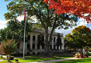
investor, built a courthouse and donated it to the county at Selmer, voters agreed to move the county seat to the
railroad town, where it remains. In addition to Purdy and Selmer, McNairy County has eight other incorporated towns:
Adamsville, Bethel Springs, Michie, Milledgeville, Finger, Ramer, Eastview, Stantonville, and Guys. Find more from the Tennessee Encyclopedia of History and Culture:
MCNAIRY COUNTY
Geography: Land and Water
As reported by the Census Bureau, the county has a total area of 561 square miles (1,453 km2), of which, 560
square miles (1,450 km2) of it is land and 1 square miles (2 km2) of it (0.14%) is water.
The major highways US Route 64 (east-west), and US Route 45 (north-south) intersect in McNairy County and
mutually bisect it into four parts. McNairy County's position on Route 64 places it on the historic Lee Highway,
which stretches from New York to San Francisco.
Neighboring Counties
Bordering counties are as follows:
- Chester County (north)
- Hardin County (east)
- Alcorn County, Mississippi (south)
- Hardeman County (west)
Education


Click Image to Enlarge
