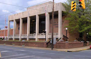
Unicoi County, Tennessee
Unicoi County Education, Geography, and History

Unicoi County is a county located in the state of Tennessee. Based on the 2010 census, the population was 18,313. Its county seat is
Erwin. Unicoi is a Cherokee word meaning "white," "hazy," "fog-like," or "fog draped."
Unicoi County is part of the Johnson City Metropolitan Statistical Area, which is a component of the Johnson City–Kingsport–Bristol, TN-VA
Combined Statistical Area, commonly known as the "Tri-Cities" region.
Etymology - Origin of Unicoi County Name
The name of which, shared with the Southern Appalachian mountains in the area, probably derives from an Indian word "u'nika" meaning white, foglike, or fog-draped.
Demographics:
County QuickFacts: CensusBureau Quick Facts
History of Unicoi County
Created 1875 from Washington and Carter counties, the name of which, shared with the Southern Appalachian mountains in the area, probably derives from an Indian word "u'nika" meaning white, fog-like, or fog-draped.
Unicoi County was formed in 1875 from Carter and Washington counties. (Public Acts of Tennessee 1875, Chapter 68).
Tennessee Encyclopedia of History and Culture
Located in the mountains of upper East Tennessee, Unicoi County covers approximately 186 square miles, of which
approximately 50 percent is owned by the US government. Unicoi is a Cherokee word meaning "white," "hazy,"
"fog-like," or "fog draped." The county's principal waterway, the Nolichucky River, originates at the point where
the North Toe River joins the Cane River in North Carolina. Nolichucky Gorge is now a popular center for white water
rafting.
Settlers arrived in the late 1770s and quickly established farms and churches. The area that is now Unicoi County
was part of Washington and Carter counties until March 23, 1875, when the Tennessee General Assembly created the new
county. The county court took office in January 1876. Erwin, which was centrally located, became the county seat.
The town had existed under various names including Unaka (1832), Longmire (1840), and Vanderbilt (1976). In December
1879, the name was changed to Ervin, in honor of David J. N. Ervin, who had donated fifteen acres for the county
seat. A mistake by postal officials, which was never corrected, recorded the name as Erwin. Find more from the Tennessee Encyclopedia of History and Culture:
UNICOI COUNTY
Geography: Land and Water
As reported by the Census Bureau, the county has a total area of 186 square miles (483 km2), of which, 186
square miles (482 km2) of it is land and 0 square miles (1 km2) of it (0.19%) is water.
Neighboring Counties
Bordering counties are as follows:
- Washington County (north)
- Carter County (northeast)
- Mitchell County, North Carolina (east)
- Yancey County, North Carolina (south)
- Madison County, North Carolina (southwest)
- Greene County (west)
Education


