


Click Image to Enlarge
Texas Counties
Texas is divided into two hundred and fifty-four counties, more than any other state. Texas was originally divided into municipalities, a unit of local government under Spanish and Mexican rule. When the Republic of Texas gained its independence in 1836, there were 23 municipalities, which became the original Texas counties. Many of these would later be divided into new counties. The most recent county to be created was Kenedy County in 1921. The most recent county to be organized was Loving County in 1931Archer County, Texas
Archer County Education, Geography, and History
Archer
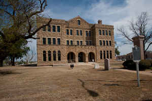
County is a county located in the US state of Texas. Based on the 2010 census, its population was 9,054. Its county seat is Archer City. The
county was formed in 1858 and later organized in 1880. It is named for Branch Tanner Archer, a commissioner for the Republic of Texas.
Archer County is part of the Wichita Falls, TX Metropolitan Statistical Area.
Etymology - Origin of Archer County Name
Branch Tanner Archer, a commissioner for the Republic of Texas
Demographics:
County QuickFacts: CensusBureau Quick Facts
Archer County History
Archer County is a county located in the US state of Texas, and was formed in 1858 from Fannin County. Archer is named for Branch Tanner Archer, a commissioner for the Republic of Texas.
Handbook of Texas Online
In November 1879 farmers combined with the small ranchers in Archer County and presented a petition to the
commissioners' court of Clay County calling for the political organization of Archer County. Larger cattle
interests, bitterly opposed to organization, protested and delayed the process, but in the spring of 1880 the court
ordered an election. Archer County was organized on July 27 of that year. More at
Monte Lewis, "ARCHER COUNTY," Handbook of Texas Online (http://www.tshaonline.org/handbook/online/articles/hca05),
accessed January 23, 2016. Uploaded on June 9, 2010. Modified on January 22, 2016. Published by the Texas State Historical Association.
Geography: Land and Water
As reported by the Census Bureau, the county has a total area of 926 square miles (2,398 km2), of which, 910 square miles (2,356 km2) of it is land and 16 square miles (42 km2) of it (1.74%) is water.
Neighboring Counties
Bordering counties are as follows:
- Wichita County (north)
- Clay County (east)
- Jack County (southeast)
- Young County (south)
- Baylor County (west)
Education
The following school districts serve Archer County:
Archer City Independent School District
Holliday Independent School District
Iowa Park Consolidated Independent School District (partial)
Jacksboro Independent School District (partial)
Olney Independent School District (partial)
Windthorst Independent School District


Click Image to Enlarge
