


Click Image to Enlarge
Texas Counties
Texas is divided into two hundred and fifty-four counties, more than any other state. Texas was originally divided into municipalities, a unit of local government under Spanish and Mexican rule. When the Republic of Texas gained its independence in 1836, there were 23 municipalities, which became the original Texas counties. Many of these would later be divided into new counties. The most recent county to be created was Kenedy County in 1921. The most recent county to be organized was Loving County in 1931Armstrong County, Texas
Armstrong County Education, Geography, and History
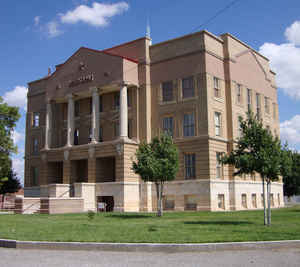
Armstrong County is a county located in the state of Texas. Based on the 2010 census, the population was 1,901. Its county seat is Claude.
The county was formed in 1876 and later organized in 1890. It was named for one of several Texas pioneer families named Armstrong.
Armstrong County is included in the Amarillo, TX Metropolitan Statistical Area.
Etymology - Origin of Armstrong County Name
It is named for one of several pioneer Texas families named Armstrong, though the sources are unclear about which one.
Demographics:
County QuickFacts: CensusBureau Quick Facts
Armstrong County History
Paleo-Indians first inhabitants as far back as 10,000 BC. Apachean cultures roamed the county until Comanche dominated around 1700. The Comanches were defeated by the United States Army in the Red River War of 1874. Later tribes include Kiowa, Cheyenne.Armstrong County was formed from Bexar County in 1876, and organized in 1890, with Claude as the county seat. Armstrong is named for one of several Texas pioneer families named Armstrong.
Charles Goodnight and John George Adair established ranching in the county. In 1876 Goodnight brought a herd of 1,600 cattle into the Palo Duro Canyon. The JA Ranch encompassed over a million acres (4,000 km2), including Armstrong County and five adjoining counties. The county land use was primarily ranch-related, even after the trickling in of homesteaders, for the remainder of the 19th Century.
Handbook of Texas Online
Although the county was marked off from Bexar County in 1876, it remained unorganized until 1890, when the
growing population felt the need for a local government. Accordingly, the county was organized in March of that
year, with Claude as the county seat. More at
Donald R. Abbe, "ARMSTRONG COUNTY," Handbook of Texas Online (http://www.tshaonline.org/handbook/online/articles/hca06),
accessed January 23, 2016. Uploaded on June 9, 2010. Modified on January 22, 2016. Published by the Texas State Historical Association.
Geography: Land and Water
As reported by the Census Bureau, the county has a total area of 914 square miles (2,367 km2), of which, 914
square miles (2,366 km2) of it is land and 0 square miles (0 km2) of it (0.02%) is water.
Neighboring Counties
Bordering counties are as follows:
- Carson County (north)
- Gray County (northeast)
- Donley County (east)
- Briscoe County (south)
- Swisher County (southwest)
- Randall County (west)
- Potter County (northwest)
Education
The Claude Independent School District serves almost all of Armstrong County.
Three school districts headquartered in surrounding counties, Clarendon Consolidated Independent School District, Groom Independent School
District, and Happy Independent School District, have small unincorporated portions of Armstrong County.


Click Image to Enlarge
