


Click Image to Enlarge
Texas Counties
Texas is divided into two hundred and fifty-four counties, more than any other state. Texas was originally divided into municipalities, a unit of local government under Spanish and Mexican rule. When the Republic of Texas gained its independence in 1836, there were 23 municipalities, which became the original Texas counties. Many of these would later be divided into new counties. The most recent county to be created was Kenedy County in 1921. The most recent county to be organized was Loving County in 1931Austin County, Texas
Austin County Education, Geography, and History
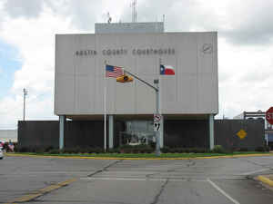
Austin County is a county in the state of Texas. Based on the 2010 census, the population was 28,417. Its seat is Bellville. The county is
named for Stephen F. Austin, who facilitated the Anglo American colonization of Texas.
Austin County is included in the Houston-The Woodlands-Sugar Land, TX Metropolitan Statistical Area.
Etymology - Origin of Austin County Name
Stephen F. Austin, the person who facilitated the Anglo American colonization of Texas and is known as the Father of Texas
Demographics:
County QuickFacts: CensusBureau Quick Facts
Austin County History
Austin County is not to be confused with the city of Austin, the state capital city that
lies in Travis County approximately 110 miles to the northwest. The area now known as Austin County was selected by Stephen Fuller Austin in 1823 as
the site for his colony, the first Anglo-American settlement in Texas. These early settlers usually built near streams where water could
easily be found and an abundance of wood for building and fencing material, as well as where fuel would be readily available.
During the early years of settlement Indians were the greatest problem and danger faced by the colonists and it appears that the Karankawas
were the most troublesome. Many women and children were killed while left unguarded as the men were working.
Austin County experienced three waves of settlement. First to arrive were the Anglo-Americans of Austin's colony who settled on the fertile
land around the Brazos and its streams. Some of these early farmers wasted the land and due to poor farming practices they were left with once
fertile soil that was no longer capable of cultivation. The Germans were the next large group to settle within Austin County. A few German
immigrants came to Texas as early as 1821, but significant numbers did not begin to settle until 1830. These farmers were of a more economical
mind and settled successfully on land the Anglos did not want. Czech immigrants were the next sizable group to settle in Austin County. Their
first settlement neat Cat Spring was founded in 1848, but there were Czechs in Texas as early as 1833. Those Czechs who established their
homes in Austin County were able to settle successfully on land left by the Germans.
The settlement of towns in Austin County began in 1823 when San Felipe de Austin was chosen as the headquarters of the colony by the first
settlers and the Baron de Bastrop. The city was named in honor of a saint and Stephen F. Austin. The name "de Austin" was removed by a
legislative act of the Republic of Texas in 1840.
The first organized opposition to Mexican rule was expressed at the Convention of 1832 which was held in San Felipe. It was at this convention
that delegates from the colonies met to discuss colonial problems. Another convention was called in 1833 and at this time a petition for
statehood was drawn up to be delivered to the authorities in Mexico. The Consultation of 1835 met in San Felipe and it was at this time that
San Felipe was made capital of the provisional government until the Convention of 1836 which met at Washington-on-the-Brazos.
San Felipe was burned in February, 1836 to keep it from falling into the hands of the approaching Mexican Army. The city was rebuilt upon its
original site and was incorporated under the Republic of Texas. Once the social and political center of Americans in Texas, as well as the
cultural and economic center, San Felipe never regained its importance following the Revolution. It remained the County seat until the
majority vote of the election of December 23, 1846 was cast in favor of moving the County seat to Bellville to a site suggested by the Bell
family. Bellville was incorporated in January, 1929.
Handbook of Texas Online
Although the state of Coahuila and Texas designated San Felipe the capital of
its Department of the Brazos in 1834, the first machinery of democratic government in Austin's colony appeared in
1828 with the establishment of the ayuntamiento of San Felipe; the municipality
over which it exercised authority extended from the Lavaca to the San Jacinto rivers and from the Old San Antonio
Road to the coast. The jurisdiction was progressively narrowed by the formation
from it of fifteen additional municipalities; by 1836 the Municipality of San Felipe had acquired boundaries
approximating those of modern Austin County, with the addition of a large region in the south that was broken off to
form Fort Bend County in 1837, and a wide strip of territory on the east bank of the Brazos, which remained in the
county until the end of Reconstruction. The Constitution of the Republic of
Texas (1836) made counties of the former Mexican municipalities, and by 1837
Austin County, named in honor of Stephen Austin, had been officially organized. Although the burning of San Felipe
left the town unavailable to serve as the capital of the republic, the partially rebuilt town became the county seat
of Austin County. After a referendum of December 1846, however, Bellville became the county seat; this new community
was near the geographical center of the county. The transfer of administrative functions was completed in January
1848. More at
Charles Christopher Jackson, "AUSTIN COUNTY," Handbook of Texas Online (http://www.tshaonline.org/handbook/online/articles/hca08),
accessed January 23, 2016. Uploaded on June 9, 2010. Modified on January 22, 2016. Published by the Texas State Historical Association.
Geography: Land and Water
As reported by the Census Bureau, the county has a total area of 656 square miles (1,700 km2), of which, 653 square miles (1,690 km2) of it is land and 4 square miles (10 km2) of it (0.58%) is water
Neighboring Counties
Bordering counties are as follows:
- Washington County (north)
- Waller County (east)
- Fort Bend County (southeast)
- Wharton County (south)
- Colorado County (west)
- Fayette County (northwest)
Education
The following school districts serve Austin County:
Bellville Independent School District
Brazos Independent School District (partial)
Brenham Independent School District (partial)
Columbus Independent School District (partial)
Sealy Independent School District


Click Image to Enlarge
