


Click Image to Enlarge
Texas Counties
Texas is divided into two hundred and fifty-four counties, more than any other state. Texas was originally divided into municipalities, a unit of local government under Spanish and Mexican rule. When the Republic of Texas gained its independence in 1836, there were 23 municipalities, which became the original Texas counties. Many of these would later be divided into new counties. The most recent county to be created was Kenedy County in 1921. The most recent county to be organized was Loving County in 1931Bastrop County, Texas
Bastrop County Education, Geography, and History
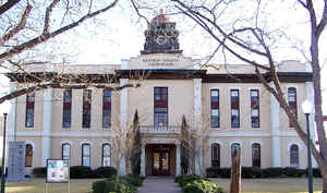
Bastrop County is a county located in the state of Texas. Based on the 2010 census, the population was 74,171. Its county seat is Bastrop.
The county was created in 1834 as a municipality of Mexico and organized as a county in 1837. It is named for Felipe Enrique Neri, Baron de
Bastrop, an early Dutch settler who assisted Stephen F. Austin in obtaining land grants in Texas.
Bastrop County is included in the Austin-Round Rock, TX Metropolitan Statistical Area.
Etymology - Origin of Bastrop County Name
Felipe Enrique Neri, Baron de Bastrop (he was actually a commoner named Philip Hendrik Nering Bogel wanted for embezzlement in his native country of the Netherlands), an early Dutch settler who assisted Stephen F. Austin in obtaining land grants.
Demographics:
County QuickFacts: CensusBureau Quick Facts
Bastrop County History
The county was created in 1834 as a municipality of Mexico and organized as a county in 1837. Its county seat is Bastrop. Bastrop County is named for Felipe Enrique Neri, Baron de Bastrop, an early Dutch settler who assisted Stephen F. Austin in obtaining land grants in Texas.
From January 8, 1836 to December 13, 1837, the Municipality and County of Mina consisted of parts of present-day Mason, Kimble, Llano, Burnet, Williamson, Gillespie, Blanco, Comal, Hays, Travis, Caldwell, Bastrop, Lee, Gonzales, Fayette, Washington, and Lavaca counties. On December 14, 1837, the Second Congress of the Republic of Texas passed legislation changing the geographical limits, creating Fayette County, removing Gonzales and Caldwell Counties from the boundaries and, five months later, added parts of Kimble and Comal Counties. On December 18, 1837, Sam Houston signed an act incorporating the town of Mina and, on the same day, changing the name of the county and town of Mina to Bastrop. May 24, 1838 to January 24, 1840, shows the borders of Bastrop County to contain parts of present-day Blanco, Burnet, Williamson, Travis, Hays, Comal, Caldwell, Bastrop, Lee, Gonzales and Fayette counties. From January 25, 1840 to January 25, 1850 the border changed to almost its present size with a small portion of Lee, Williamson, Caldwell, Gonzales and Fayette counties included.
Handbook of Texas Online
In 1831 Austin received a second land grant; the two grants, Mina Municipality,
took in almost all of what is now Bastrop County. The district was presumably named in honor of Spanish general
Francisco Xavier Mina. In 1834 the vast municipality, comprising all or part of
sixteen present-day counties, was established by the government of Coahuila and Texas,
and the town of Bastrop also took the name Mina. When Texas became a republic, Mina Municipality assumed its place
as one of twenty-three original counties. In 1837 the Congress of the Republic of Texas
changed the county name to Bastrop in honor of the baron and allowed the town to revert to the name as well.
Congress also began whittling away at the boundaries of the huge county; in 1840, when Travis County was formed,
Bastrop County shrank almost to its present dimensions. More at
Paula Mitchell Marks, "BASTROP COUNTY," Handbook of Texas Online (http://www.tshaonline.org/handbook/online/articles/hcb03),
accessed January 23, 2016. Uploaded on June 12, 2010. Modified on January 22, 2016. Published by the Texas State Historical Association.
Geography: Land and Water
As reported by the Census Bureau, the county has a total area of 896 square miles (2,320 km2), of which, 888 square miles (2,301 km2) of it is land and 8 square miles (20 km2) of it (0.84%) is water.
Neighboring Counties
Bordering counties are as follows:
- Williamson County (north)
- Lee County (northeast)
- Fayette County (southeast)
- Caldwell County (southwest)
- Travis County (northwest)
Education
The following school districts serve Bastrop County:
Bastrop Independent School District
Elgin Independent School District (partial)
McDade Independent School District
Smithville Independent School District (partial)


Click Image to Enlarge
