


Click Image to Enlarge
Texas Counties
Texas is divided into two hundred and fifty-four counties, more than any other state. Texas was originally divided into municipalities, a unit of local government under Spanish and Mexican rule. When the Republic of Texas gained its independence in 1836, there were 23 municipalities, which became the original Texas counties. Many of these would later be divided into new counties. The most recent county to be created was Kenedy County in 1921. The most recent county to be organized was Loving County in 1931Brewster County, Texas
Brewster County Education, Geography, and History
Brewster County is a county located in the western part of the state of Texas. Based on the 2010 census, the population was 9,232. Its county seat and only city is Alpine. The county is named for Colonel Henry Percy Brewster, a Secretary of War for the Republic of Texas.
Etymology - Origin of Brewster County Name
Henry Percy Brewster, a secretary of war for the Republic of Texas and soldier in the Civil War (his middle name has also been given as "Persy")
Demographics:
County QuickFacts: CensusBureau Quick Facts
Brewster County History
Paleo-Indian hunter-gatherers existed there at least 9000 years ago. Mescalaro Apaches emerged later and conducted
raids that discouraged settlers. Between 1779 and 1787, Col. Juan de Ugalde drove the Mescalaros back across the Rio Grande and into the
Chisos Mountains. The three leading Mescalero chiefs, Patula Grande, Quemado, and Zapato Tuerto, agreed in March 1789 to submit to Spanish
rule. Comanche raiding parties continued through much of the 19th century.
Spanish explorers Álvar Núñez Cabeza de Vaca in 1535 and Antonio de Espejo in 1583 crossed Brewster County on their way to La Junta de los
Ríos, the junction of the Rio Grande and the Rio Conchos.
In 1684, Juan Domínguez de Mendoza camped at Kokernot Spring and wrote the earliest recorded description of it.
Pedro de Rábago y Terán, Governor of Coahuila in the 1740s, led an expedition to La Junta de los Ríos.
Northern Mexican military governor Lt. Col. Hugo Oconór led a 1772 expedition to locate sites for forts on the Comanche Trail along the Rio
Grande.
In October 1851, Danish-born Col. Edvard Emil Langberg, Mexican commandant of Chihuahua, visited southern Brewster County.
Surveyor William H. Emory in 1852 sent M. T. W. Chandler to survey what is now the heart of Big Bend National Park. Chandler explored Santa
Elena Canyon, the Chisos Mountains Mariscal Canyon, and Boquillas Canyon.
An 1859 expedition of the US Camel Corps under 2d Lt. Edward L. Hartz explored the Comanche Trail through Persimmon Gap and down Tornillo
Creek to the Rio Grande. A year later, a second camel expedition under 2d Lt. William Echols also explored along the Rio Grande.
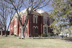
Brewster County was marked off in 1887 from Presidio County and named for Henry Percy Brewster. Murphyville, later renamed Alpine, was
selected as county seat.
Brewster is named for Henry Percy Brewster, a secretary of war for the Republic of Texas. The county is the largest in
the state.
Handbook of Texas Online
These two quickly became shipping points and important supply centers for the booming cattle industry. Five years
after the coming of the railroad, in 1887, Brewster County was marked off from Presidio County, as were Jeff Davis, Buchel, and Foley counties. Brewster County was named for Henry P. Brewster,
secretary of war under David G. Burnet. Buchel and Foley counties
were not organized and were attached to Brewster County for judicial purposes. The first Brewster County elections
were held on February 4, 1887, when Murphyville was selected as county seat; on March 14 of that year a contract was
let for the construction of the Brewster County courthouse and jail. In 1890 Brewster County had just 710 residents,
while Buchel and Foley counties had only 298 and 25 residents respectively. By 1897 Buchel and Foley counties had
still not been organized, and in that year their territory was officially added to that of Brewster County, making
the latter the largest county in Texas. More at
Martin Donell Kohout, "BREWSTER COUNTY," Handbook of Texas Online (http://www.tshaonline.org/handbook/online/articles/hcb14),
accessed January 23, 2016. Uploaded on June 12, 2010. Published by the Texas State Historical Association.
Geography: Land and Water
As reported by the Census Bureau, the county has a total area of 6,193 square miles (16,039 km2), none of which is covered in water.
Brewster County is the largest county by area in the state, over three times the size of the state of Delaware, and more than 500 square miles (1,300 km2) bigger than Connecticut.It is one of the nine counties that comprise the Trans-Pecos region of West Texas, and borders Mexico.
Neighboring Counties
Bordering counties are as follows:
- Pecos County (north)
- Terrell County (northeast)
- Presidio County (west)
- Jeff Davis County (northwest)
- Manuel Benavides, Chihuahua, Mexico (southwest)
- Acu?, Coahuila, Mexico (southeast)
- Ocampo, Coahuila, Mexico (south)
Education
These school districts serve Brewster County:
Alpine Independent School District
Marathon Independent School District
San Vicente Independent School District (K-8 only) (high schoolers attend Terlingua CSD)
Terlingua Common School District
In addition, Sul Ross State University is located in Alpine.


Click Image to Enlarge
