


Click Image to Enlarge
Texas Counties
Texas is divided into two hundred and fifty-four counties, more than any other state. Texas was originally divided into municipalities, a unit of local government under Spanish and Mexican rule. When the Republic of Texas gained its independence in 1836, there were 23 municipalities, which became the original Texas counties. Many of these would later be divided into new counties. The most recent county to be created was Kenedy County in 1921. The most recent county to be organized was Loving County in 1931Briscoe County, Texas
Briscoe County Education, Geography, and History
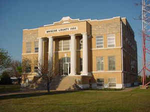
Briscoe County is a county located in the state of Texas. As of 2010 census, the population was 1,637. Its county seat is Silverton. The county was created in 1876 and later organized in 1892. It is named for Andrew Briscoe, a soldier during the Texas Revolution.
Etymology - Origin of Briscoe County Name
Andrew Briscoe, a soldier during the Texas Revolution
Demographics:
County QuickFacts: CensusBureau Quick Facts
Briscoe County History
The county was created in 1876. On March 15, 1892, the electorate officially organized the Briscoe county and chose Silverton as its seat. Briscoe is named for Andrew Briscoe, a soldier during the Texas Revolution.
Handbook of Texas Online
The town of Quitaque began in 1890 as a stage stop. Merchants and other businessmen also trickled in; in 1891
Thomas J. Braidfoot laid out the townsite of Silverton and led the movement for the organization of the county. By
the spring of 1892 enough settlers had arrived to bring Braidfoot's plan to fruition. A petition was circulated, and
on March 15, 1892, the electorate officially organized the county and chose Silverton as its seat. J. N. Stalbird
was elected the first county judge, F. D. Fisher county attorney, R. I. Hanna treasurer, T. L. Anderson clerk, and
Miner Crawford sheriff. By 1900 the population had grown to 1,253, and six school districts had been established.
Immigrant farmers introduced various crops to the region before World War I, the
most promising of which were wheat, sorghum, and cotton. Cotton was first grown in Briscoe County on an experimental
basis but became one of the county's most important crops by 1930. In 1900 only eight acres of Briscoe County land
was planted in cotton; in 1910 over 3,400 acres were devoted to the fiber, then 7,535 acres in 1920, and over 36,000
acres in 1929. The county's first gin was built in 1912. More at
Donald R. Abbe and H. Allen Anderson, "BRISCOE COUNTY," Handbook of Texas Online (http://www.tshaonline.org/handbook/online/articles/hcb15),
accessed January 23, 2016. Uploaded on June 12, 2010. Published by the Texas State Historical Association.
Geography: Land and Water
As reported by the Census Bureau, the county has a total area of 902 square miles (2,335 km2), of which, 901 square miles (2,332 km2) of it is land and 1 square miles (3 km2) of it (0.15%) is water.
Briscoe County is on the edge of the Texas High Plains along the eastern Caprock escarpment, which separates the Llano Estacado from the
Rolling Plains.
Neighboring Counties
Bordering counties are as follows:
- Armstrong County (north)
- Donley County (northeast)
- Hall County (east)
- Motley County (southeast)
- Floyd County (south)
- Swisher County (west)
Education
Silverton Independent School District
Clarendon Independent School District partial
Turkey-Quitaque Independent School District partial


Click Image to Enlarge
