


Click Image to Enlarge
Texas Counties
Texas is divided into two hundred and fifty-four counties, more than any other state. Texas was originally divided into municipalities, a unit of local government under Spanish and Mexican rule. When the Republic of Texas gained its independence in 1836, there were 23 municipalities, which became the original Texas counties. Many of these would later be divided into new counties. The most recent county to be created was Kenedy County in 1921. The most recent county to be organized was Loving County in 1931Burnet County, Texas
Burnet County Education, Geography, and History
Burnet County is a county located on the Edwards Plateau in the state of Texas. Based on the 2010 census, the population was 42,750. Its county seat is Burnet. The county was founded in 1852 and later organized in 1854.It is named for David Gouverneur Burnet, the first (provisional) president of the Republic of Texas. The name of the county is pronounced with the emphasis or accent on the first syllable, just as its namesake David Burnet.
Etymology - Origin of Burnet County Name
David Gouverneur Burnet, the first president of the Republic of Texas
Demographics:
County QuickFacts: CensusBureau Quick Facts
Burnet County History
Indigenous peoples inhabit the area as early as 4500 B.C. Later known tribes in the area include Tonkawa, Lipan
Apache and Comanche.
During the 1820s-1830s Stephen F. Austin and Green DeWitt surveying and Indian fighting explorations.In 1849 the United States established
Fort Croghan and in 1848 First settlers arrived in the county. In 1851 Twenty Mormon families under the leadership of Lyman Wight establish a
colony at Hamilton Creek, later to be known as Morman Mill.
Burnet County was formed by the Fourth Texas Legislature on February 5, 1852, from parts of Travis, Williamson, and Bell counties. It was
named for David G. Burnet, president of the provisional government of the Republic of Texas. The first county officials were elected later
that year.
Residents of the new county were divided on the issue of where to locate the county seat. Some thought it should be on Oatmeal Creek, east of
the watershed separating the Brazos and Colorado rivers; others wanted it to be on Delaware Creek, just southwest of the site of Burnet. The
faction that won included Vandeveer, Holland, and Kerr, who argued that Hamilton should be the county seat. To help convince people, Kerr
donated 100 acres to the county for a townsite. The first post office in the county was established at Hamilton in 1853; the name of the town
was changed to Burnet in February 1858.
Handbook of Texas Online
The presence of troops had encouraged settlers to make their homes in Burnet County. Among these were such county
notables as Noah Smithwick, Logan Vandeveer, and Peter Kerr. A group of Mormons
led by Lyman Wight established a colony at the falls of Hamilton Creek in 1851.
By December 1851 the population of the region was large enough to warrant petitioning for the foundation of a new
county. Burnet County was formed by the Fourth Texas Legislature on February 5, 1852, from parts of Travis,
Williamson, and Bell counties. It was named for David G. Burnet, president of
the provisional government of the Republic of Texas.
The first county officials were elected later that year. More at
Vivian Elizabeth Smyrl, "BURNET COUNTY," Handbook of Texas Online (http://www.tshaonline.org/handbook/online/articles/hcb19),
accessed January 23, 2016. Uploaded on June 12, 2010. Published by the Texas State Historical Association.
Judicial Burnet County
Burnet County was established by the Fifth Congress as a judicial county on January 30, 1841. It lay between the Neches and Trinity rivers south of Nacogdoches County and north of Houston County. Fort Houston, the earliest settlement in the area and the temporary seat of justice, had a Sunday school and a temperance society organized in 1840. Peter Fullenwider held Presbyterian services. Magnolia, a projected town on the Trinity River, was intended as a riverport. The Telegraph and Texas Registerqv of September 15, 1841, described the terrain and possibilities of the county and estimated that its population had increased from 250 to 500 between 1839 and 1841. An act of December 6, 1841, provided for a better definition of county boundaries, made Fort Houston the permanent seat of justice, and authorized the county to raise a company of volunteers for protection of the frontier. The county ceased to exist, probably when judicial counties were declared unconstitutional in the case of Stockton v. Montgomery in 1842.
BIBLIOGRAPHY: R. L. Batts, "Defunct Counties of Texas," Quarterly of the Texas State Historical Association 1 (October 1897). James Wilmer Dallam, A Digest of the Laws of Texas (Baltimore: Toy, 1845). Hans Peter Nielsen Gammel, comp., Laws of Texas, 1822-1897 (10 vols., Austin: Gammel, 1898).
Geography: Land and Water
As reported by the Census Bureau, the county has a total area of 1,021 square miles (2,644 km2), of which, 996
square miles (2,580 km2) of it is land and 25 square miles (65 km2) of it (2.44%) is water.
Neighboring Counties
Bordering counties are as follows:
- Lampasas County (north)
- Bell County (northeast)
- Williamson County (east)
- Travis County (southeast)
- Blanco County (south)
- Llano County (west)
- San Saba County (northwest)
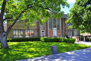
Education


Click Image to Enlarge
