


Click Image to Enlarge
Texas Counties
Texas is divided into two hundred and fifty-four counties, more than any other state. Texas was originally divided into municipalities, a unit of local government under Spanish and Mexican rule. When the Republic of Texas gained its independence in 1836, there were 23 municipalities, which became the original Texas counties. Many of these would later be divided into new counties. The most recent county to be created was Kenedy County in 1921. The most recent county to be organized was Loving County in 1931Calhoun County, Texas
Calhoun County Education, Geography, and History
Calhoun County is a county located in the state of Texas. Based on the 2010 census, the population was 21,381. Its county seat is Port
Lavaca. The county is named for John Caldwell Calhoun, the seventh vice president of the United States.
Calhoun County comprises the Port Lavaca, TX Micropolitan Statistical Area, which is also included in the Victoria-Port Lavaca, TX
Combined Statistical Area.
Etymology - Origin of Calhoun County Name
John Caldwell Calhoun, the seventh vice president of the United States
Demographics:
County QuickFacts: CensusBureau Quick Facts
Calhoun County History
On April 4, 1846, Calhoun County was formed from parts of Victoria, Jackson, and Matagorda counties and named for John C. Calhoun of South Carolina, who had advocated Texas statehood. Lavaca was the first county seat. But, as a result of the development of the Indianola ,
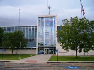
Calhoun County has had two county seats and five courthouses. The first county seat and courthouse was in Lavaca, 1846-1852. The county seat was moved to Indianola in 1852 with the railroad, the formation of other transportation lines, and a shift of population where the second courthouse was built in 1857 and destroyed by hurricane, along with most of Indianola in 1886. The county seat was moved back to Lavaca (now renamed Port Lavaca), where a new courthouse was built in 1887. Another courthouse was built in 1912, above, and later demolished in 1959, when the current courthouse, below, was opened.
Handbook of Texas Online
On April 4, 1846, Calhoun County was formed from parts of Victoria, Jackson, and Matagorda counties and named for
John C. Calhoun of South Carolina, who had advocated Texas statehood. Lavaca was the first county seat. But, as a
result of the development of the Indianola Railroad, the formation of other transportation lines, and a shift of
population, Indianola became more important and was made county seat in 1852. The county's earliest newspaper, the
Lavaca Journal, began publication in 1848; the first county school opened at Lavaca in 1849; and a county
courthouse was completed at Indianola in 1857. Both Lavaca and Indianola remained important trade centers until
1861. Exports from Lavaca included cotton, pecans, and lead and copper from Mexico; Indianola exported silver
bullion and cattle. The Morgan Lines moved their headquarters from Lavaca to
Indianola in 1849, and in 1852 operated regular service to New York. The San Antonio and Mexican Gulf Railway
completed a line from Lavaca to Victoria by 1861, and the Indianola Railroad was completed in the 1870s. Both roads
eventually became parts of the Southern Pacific system. Trade development ceased, however, with the beginning of the
Civil War. More at
Diana J. Kleiner, "CALHOUN COUNTY," Handbook of Texas Online (http://www.tshaonline.org/handbook/online/articles/hcc02),
accessed January 23, 2016. Uploaded on June 12, 2010. Published by the Texas State Historical Association.
Geography: Land and Water
As reported by the Census Bureau, the county has a total area of 1,032 square miles (2,673 km2), of which, 512 square miles (1,327 km2) of it is land and 520 square miles (1,346 km2) of it (50.36%) is water.
The altitude of this Coastal Prairie county ranges from sea level to fifty feet. The terrain is flat, poorly to moderately well
drained, and surfaced with loams underlain by cracking, clayey subsoils, including deep black soils and sandy clay. Matagorda Island, on
the southern fringe of the county, is chiefly deep shell sand.
Neighboring Counties
Bordering counties are as follows:
- Jackson County (north)
- Matagorda County (east)
- Gulf of Mexico (southeast)
- Aransas County (southwest)
- Refugio County (west)
- Victoria County (northwest)
Education
All of Calhoun County is served by the Calhoun County Independent School District.
Our Lady of the Gulf Catholic school, pre-K through grade 8, has also served the county since 1996.


Click Image to Enlarge
