


Click Image to Enlarge
Texas Counties
Texas is divided into two hundred and fifty-four counties, more than any other state. Texas was originally divided into municipalities, a unit of local government under Spanish and Mexican rule. When the Republic of Texas gained its independence in 1836, there were 23 municipalities, which became the original Texas counties. Many of these would later be divided into new counties. The most recent county to be created was Kenedy County in 1921. The most recent county to be organized was Loving County in 1931Collingsworth County, Texas
Collingsworth County Education, Geography, and History
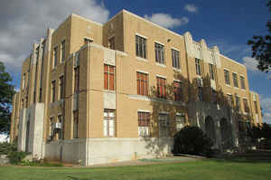
Collingsworth County is a county located in the state of Texas. Based on the 2010 census, its population was 3,057. Its county seat is Wellington. The county was created in 1876 and later organized in 1890. It is named for James Collinsworth, a signer of the Texas Declaration of Independence and first chief justice of the Republic of Texas (a recording error in the bill accounts for the error in spelling, which was never corrected.
Etymology - Origin of Collingsworth County Name
James Collinsworth, a signer of the Texas Declaration of Independence and first chief justice of the Republic of Texas (spelling differs due to an error in the bill creating the county)
Demographics:
County QuickFacts: CensusBureau Quick Facts
Collingsworth County History
Collingsworth County was created 21 August 1876 from Bexar Land District. Collingsworth is named for James Collinsworth, a signer of the Texas Declaration of Independence and first chief justice of the Republic of Texas. The reason the county's name is spelled differently is because the bill creating the county misspelled Collinsworth's name. Its seat is Wellington.
It is north of Childress County, which is named for George Campbell Childress, another founder of the Republic of Texas.
Handbook of Texas Online
The area that is now Collingsworth County was occupied by Apaches from prehistoric times until about 1700, when Comanches and Kiowas moved in. These tribes dominated the Panhandle until they
were crushed by the United States Army in the Red River War of 1874 and removed
permanently to reservations in Indian Territory. The Panhandle was thus opened for settlement. In 1876 the Texas
legislature formed Collingsworth County of land previously assigned to Bexar and Young counties. More at
Donald R. Abbe, "COLLINGSWORTH COUNTY," Handbook of Texas Online (http://www.tshaonline.org/handbook/online/articles/hcc17),
accessed January 23, 2016. Uploaded on June 12, 2010. Published by the Texas State Historical Association.
Geography: Land and Water
As reported by the Census Bureau, the county has a total area of 919 square miles (2,381 km2), of which, 918 square miles (2,380 km2) of it is land and 1 square miles (1 km2) of it (0.07%) is water.
Neighboring Counties
Bordering counties are as follows:
- Wheeler County (north)
- Beckham County, Oklahoma (northeast)
- Harmon County, Oklahoma (southeast)
- Childress County (south)
- Hall County (southwest)
- Donley County (west)
Education


Click Image to Enlarge
