


Click Image to Enlarge
Texas Counties
Texas is divided into two hundred and fifty-four counties, more than any other state. Texas was originally divided into municipalities, a unit of local government under Spanish and Mexican rule. When the Republic of Texas gained its independence in 1836, there were 23 municipalities, which became the original Texas counties. Many of these would later be divided into new counties. The most recent county to be created was Kenedy County in 1921. The most recent county to be organized was Loving County in 1931Comal County, Texas
Comal County Education, Geography, and History
Comal County is a county located on the Edwards Plateau in the state of Texas. Based on the 2010 census, its population was 108,472. Its
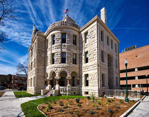
county seat is New Braunfels.
Comal County is part of the San Antonio-New Braunfels, TX Metropolitan Statistical Area.
Etymology - Origin of Comal County Name
the Comal River; the name means basin or flat dish in Spanish
Demographics:
County QuickFacts: CensusBureau Quick Facts
Comal County History
Comal County is a county located in the US state of Texas. Its seat is New Braunfels.
Handbook of Texas Online
Permanent settlement of the county began in 1845, when Prince Carl of Solms-Braunfels
secured title to 1,265 acres of the Veramendi grant, including the Comal springs and river, for the Adelsverein.
In succeeding years thousands of Germans and Americans were attracted to the
rich farm and ranch land around New Braunfels. Settlement progressed rapidly; in March 1846 the Texas legislature
formed Comal County from the Eighth Precinct of Bexar County and made New Braunfels the county seat. The final
boundary determination was made in 1858 with the separation of part of western Comal County to Blanco and Kendall
counties. The first county elections were held on July 13, 1846. It is estimated that in 1850 New Braunfels was the
fourth largest city in Texas. In 1854 the county commissioners divided the county into eight public school
districts, and in 1858, long before they were required by law to do so, New Braunfels citizens voted to collect a
tax for support of public schools. The population of the county grew 133 percent between 1850 and 1860, and numbered
more than 4,000 on the eve of the Civil War.
More at
Daniel P. Greene, "COMAL COUNTY," Handbook of Texas Online (http://www.tshaonline.org/handbook/online/articles/hcc19),
accessed January 23, 2016. Uploaded on June 12, 2010. Published by the Texas State Historical Association.
Geography: Land and Water
As reported by the Census Bureau, the county has a total area of 575 square miles (1,488 km2), of which, 561
square miles (1,454 km2) of it is land and 13 square miles (34 km2) of it (2.29%) is water.
The Balcones Escarpment runs northeastward through the county, generally just west of Interstate 35. West of the
escarpment are the rocky hills and canyons of the Texas Hill Country; to the east are the rolling grasslands of the
coastal plains.
The Guadalupe River flows generally southeastward through the county, and is impounded by Canyon Lake. The Comal
River rises from the Comal Springs in New Braunfels, and quickly joins the Guadalupe River.
Neighboring Counties
Bordering counties are as follows:
- Blanco County (north)
- Hays County (northeast)
- Guadalupe County (southeast)
- Bexar County (southwest)
- Kendall County (northwest)
Education


Click Image to Enlarge
