


Click Image to Enlarge
Texas Counties
Texas is divided into two hundred and fifty-four counties, more than any other state. Texas was originally divided into municipalities, a unit of local government under Spanish and Mexican rule. When the Republic of Texas gained its independence in 1836, there were 23 municipalities, which became the original Texas counties. Many of these would later be divided into new counties. The most recent county to be created was Kenedy County in 1921. The most recent county to be organized was Loving County in 1931Concho County, Texas
Concho County Education, Geography, and History
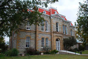
Concho County is a county located on the Edwards Plateau in the state of Texas. Based on the 2010 census, the population was 4,087. Its county seat is Paint Rock. The county was founded in 1858 and later organized in 1879. It is named for the Concho River.
Etymology - Origin of Concho County Name
the Concho River. Concho is Spanish for "shell"; the river was so named due to a discovery of freshwater mussels which produced pearls, though not in sufficient economic quantities. The pearls are unique in that they often have have a distinct pink to purple hue. These are the only pearls in the world to display this distinct color change.
Demographics:
County QuickFacts: CensusBureau Quick Facts
Concho County History
Concho County is a county located in the US state of Texas. Its county seat is Paint Rock. Concho is named for the Concho River.
Handbook of Texas Online
The legislature formed Concho County out of Bexar County in 1858, but it was not organized until 1879. In the
meantime, in the early to middle 1860s, cattlemen began to move into the open range in Concho and adjacent counties.
John S. Chisum, the first large-scale cattleman in the county, established a
string of cow camps on the Concho River in the northeastern part of the county in 1862 or 1863. He moved his
headquarters to New Mexico in 1873, though he still had a camp on the Concho near the site of present-day Paint Rock
in the fall of that year. There is no record of his activity in the area after 1875. Other large early operations
included the U-Bar and OH Ranch, or Concho Cattle Company, which first ran cattle about 1878, and the Davies and
Holland Ranch. Both of these operated in the 1880s and 1890s. For the most part, however, ranching in Concho County
was relatively small-scale. More at
Mary M. Standifer, "CONCHO COUNTY," Handbook of Texas Online (http://www.tshaonline.org/handbook/online/articles/hcc21),
accessed January 23, 2016. Uploaded on June 12, 2010. Published by the Texas State Historical Association.
Geography: Land and Water
As reported by the Census Bureau, the county has a total area of 994 square miles (2,574 km2), of which, 991
square miles (2,568 km2) of it is land and 3 square miles (6 km2) of it (0.22%) is water.
Neighboring Counties
Bordering counties are as follows:
- Runnels County (north)
- Coleman County (northeast)
- McCulloch County (east)
- Menard County (south)
- Tom Green County (west)
Education


Click Image to Enlarge
