


Click Image to Enlarge
Texas Counties
Texas is divided into two hundred and fifty-four counties, more than any other state. Texas was originally divided into municipalities, a unit of local government under Spanish and Mexican rule. When the Republic of Texas gained its independence in 1836, there were 23 municipalities, which became the original Texas counties. Many of these would later be divided into new counties. The most recent county to be created was Kenedy County in 1921. The most recent county to be organized was Loving County in 1931Coryell County, Texas
Coryell County Education, Geography, and History
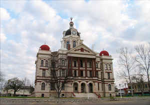
Coryell County is a county located on the Edwards Plateau in the state of Texas. Based on the 2010 census, its population was 75,388. The
county seat is Gatesville.] The county is named for James Coryell, a frontiersman and Texas Ranger who was killed by Comanche Indians while
protecting settlers.
Coryell County is part of the Killeen-Temple, TX Metropolitan Statistical Area.
Etymology - Origin of Coryell County Name
James Coryell, a frontiersman who was killed by Native Americans
Demographics:
County QuickFacts: CensusBureau Quick Facts
Coryell County History
Coryell County is located in the US state of Texas. It is named for James Coryell, a frontiersman who was killed by Indians.
Handbook of Texas Online
The area that became Coryell County was part of the Milam Land District, assigned by the Mexican government for
settlement first to Robert Leftwich in 1825, and later to Sterling C. Robertson.
Some of the land was surveyed as early as 1835, but few settlements existed before the late 1840s, when the United
States established Fort Gates and other military posts along the frontier to protect incoming residents from
Indians. The line of frontier forts was moved farther west in the early 1850s, and Fort Gates was abandoned in 1852.
Settlers in the Fort Gates area numbered about 250 at that time, and they began to campaign for a county seat. In
1854 the legislature established Coryell County and named it in honor of frontiersman James Coryell,
an early landholder. Residents chose the site for Gatesville, the county seat, in an election held in May 1854. More at
Vivian Elizabeth Smyrl, "CORYELL COUNTY," Handbook of Texas Online (http://www.tshaonline.org/handbook/online/articles/hcc23),
accessed January 23, 2016. Uploaded on June 12, 2010. Published by the Texas State Historical Association.
Geography: Land and Water
As reported by the Census Bureau, the county has a total area of 1,057 square miles (2,737 km2), of which,
1,052 square miles (2,724 km2) of it is land and 5 square miles (13 km2) of it (0.47%) is water.
Neighboring Counties
Bordering counties are as follows:
- Bosque County (north)
- McLennan County (northeast)
- Bell County (southeast)
- Lampasas County (southwest)
- Hamilton County (northwest)
Education


Click Image to Enlarge
