


Click Image to Enlarge
Texas Counties
Texas is divided into two hundred and fifty-four counties, more than any other state. Texas was originally divided into municipalities, a unit of local government under Spanish and Mexican rule. When the Republic of Texas gained its independence in 1836, there were 23 municipalities, which became the original Texas counties. Many of these would later be divided into new counties. The most recent county to be created was Kenedy County in 1921. The most recent county to be organized was Loving County in 1931Crockett County, Texas
Crockett County Education, Geography, and History
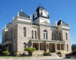
Crockett County is a county located on the Edwards Plateau in the state of Texas. Based on the 2010 census, its population was 3,719. The county seat is Ozona. The county was founded in 1875 and later organized in 1891. It is named in honor of Davy Crockett, the legendary frontiersman who died at the Battle of the Alamo.
Etymology - Origin of Crockett County Name
David Crockett, the legendary frontiersman who died at the Battle of the Alamo
Demographics:
County QuickFacts: CensusBureau Quick Facts
Crockett County History
Crockett County is a county located in the US state of Texas. It is named in honor of Davy Crockett, the legendary frontiersman who died at the Battle of the Alamo. The county seat is Ozona
Handbook of Texas Online
On January 12, 1875, Crockett County, named for David Crockett of Alamo
fame, was formed from Bexar County and attached to Kinney County for judicial purposes. It included the future
Sutton and Schleicher counties and parts of the future Val Verde, Kinney, and Edwards counties. From the earliest
settlement the economy was dependent on sheep and cattle ranching. In 1880 Crockett County reported fifteen farms,
valued together at more than $44,500. Livestock consisted mostly of beef cattle, sheep, and hogs, which were in the
aggregate worth $14,500. The county that year had 127 white residents, of whom eight were foreign-born. With the
threat of Indian attack past in the 1880s, sheep and cattle ranchers were enticed to the new county by cheap
grassland available for lease from both the railroad and the state. Among the first settlers was W. P. Hoover. The
Hoovers located on the Pecos River near Cedar Springs and above the mouth of Howard Canyon in 1881. There they
leased railroad land at five cents an acre. In 1885 Val Verde County was organized and Crockett County became a
subsidiary of it. Two years later, on March 15, 1887, Crockett County was reduced to its present size when Sutton
and Schleicher counties were cut away. Even with less territory in 1890, the county noted an increase in the number
of farms to twenty-three. The mostly owner-operated ranches reported livestock valued at more than $222,000. Sheep
numbered more than 35,000 and cattle more than 22,000. By 1890 the population increased to 194, still all white.
Thirty-two were foreign-born. More at
Julia Cauble Smith, "CROCKETT COUNTY," Handbook of Texas Online (http://www.tshaonline.org/handbook/online/articles/hcc26),
accessed January 23, 2016. Uploaded on June 12, 2010. Published by the Texas State Historical Association.
Geography: Land and Water
As reported by the Census Bureau, the county has a total area of 2,807 square miles (7,271 km2), virtually all
of which is land.
Neighboring Counties
Bordering counties are as follows:
- Upton County (north)
- Reagan County (north)
- Irion County (northeast)
- Schleicher County (east)
- Sutton County (east)
- Val Verde County (south)
- Terrell County (southwest)
- Pecos County (west)
- Crane County (northwest)
Education


Click Image to Enlarge
