


Click Image to Enlarge
Texas Counties
Texas is divided into two hundred and fifty-four counties, more than any other state. Texas was originally divided into municipalities, a unit of local government under Spanish and Mexican rule. When the Republic of Texas gained its independence in 1836, there were 23 municipalities, which became the original Texas counties. Many of these would later be divided into new counties. The most recent county to be created was Kenedy County in 1921. The most recent county to be organized was Loving County in 1931Dallam County, Texas
Dallam County Education, Geography, and History
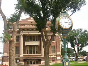
Dallam County is a county located in the northwestern corner of the state of Texas. Based on the 2010 census, its population was 6,703. Its
county seat is Dalhart. The county was founded in 1876 and later organized in 1891. It is named for James Wilmer Dallam, a lawyer and
newspaper publisher.
Dallam is the northernmost of the ten Texas counties that from 1885-1912 constituted the legendary XIT Ranch. The ranch is still celebrated
through the XIT Museum in Dalhart and the annual XIT Rodeo and Reunion held the first long weekend in August.
Etymology - Origin of Dallam County Name
James Wilmer Dallam, a lawyer and newspaper publisher
Demographics:
County QuickFacts: CensusBureau Quick Facts
Dallam County History
Dallam County is a county located in the far northwestern portion of the US state of Texas. It is named for James
Wilmer Dallam, a lawyer and newspaper publisher. Its seat is Dalhart.
Handbook of Texas Online
With the removal of the Comanches and Kiowas to Indian Territory as a result of the Red River War
in 1874-75, the Anglo-American frontier moved into the region. Dallam County, named for James W. Dallam,
Republic of Texas lawyer and newspaper editor, originated from the Bexar District in 1876. However, no exploitation
of the area actually occurred until about six years later. On January 10, 1882, the Capitol Freehold Land and
Investment Company received approximately two-thirds of the county as part of
its famous XIT Ranch holdings. Buffalo Springs, in the northern part of the
county, served as the first headquarters of the XIT. Between 1882 and 1887 only XIT cowboys and a few other settlers
occupied the county. In 1887 and 1888 the Fort Worth and Denver City Railway was built through the county as it
extended its line from Amarillo into New Mexico and Colorado. On May 14, 1888, the road reached Texline, the
railroad's choice of a new division point. Perico, twelve miles southeast, began as a shipping point for the XIT. By
1890 the population of the county had reached 112. In 1891 the county was organized with Texline as its seat.
Organization led to the county's first election, in which John V. Farwell was
chosen county judge and H. Willis, T. H. Hardin, J. L. Baughn, and J. B. Stevens county commissioners. More at
Donald R. Abbe and H. Allen Anderson, "DALLAM COUNTY," Handbook of Texas Online (http://www.tshaonline.org/handbook/online/articles/hcd01),
accessed January 23, 2016. Uploaded on June 12, 2010. Modified on April 27, 2015. Published by the Texas State Historical Association.
Geography: Land and Water
As reported by the Census Bureau, the county has a total area of 1,505 square miles (3,899 km2), of which, 1,504 square miles (3,897 km2) of it is land and 1 square miles (2 km2) of it (0.04%) is water.
Neighboring Counties
Bordering counties are as follows:
- Cimarron County, Oklahoma (north)
- Sherman County, Texas (east)
- Hartley County, Texas (south)
- Union County, New Mexico (west)
Education
The following school districts serve Dallam County:
Dalhart Independent School District
Stratford Independent School District
Texline Independent School District


Click Image to Enlarge
