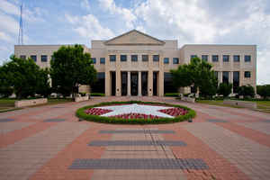
Texas Counties
Texas is divided into two hundred and fifty-four counties, more than any other state. Texas was originally divided into municipalities, a unit of local government under Spanish and Mexican rule. When the Republic of Texas gained its independence in 1836, there were 23 municipalities, which became the original Texas counties. Many of these would later be divided into new counties. The most recent county to be created was Kenedy County in 1921. The most recent county to be organized was Loving County in 1931Denton County, Texas
Denton County Education, Geography, and History

Denton County is a county in the state of Texas. Based on the 2010 census, its population was 662,614, making it the ninth-most populous county in
Texas. The county seat is Denton. The county, which was named for John B. Denton, was established in 1846.
Denton County is included in the Dallas-Fort Worth-Arlington, TX Metropolitan Statistical Area.
Etymology - Origin of Denton County Name
John Bunyan Denton, a preacher, lawyer, and soldier killed during a raid on a Native American camp
Demographics:
County QuickFacts: CensusBureau Quick Facts
Denton County History
Denton County is a county located in the US state of Texas. The county seat is Denton. The county and the city are both named for John B. Denton, who was a preacher, lawyer, and soldier.
Handbook of Texas Online
In 1846, the Texas legislature formed Denton County out of what had been a much larger Fannin County. It was named
for John Bunyan Denton, an eastern Fannin County Methodist preacher and lawyer,
who was killed in a raid against Indians in northern Tarrant County on May 22, 1841. A county seat, named
Pinckneyville, was located near the center of the county, at a spot about a mile southeast of the present center of
Denton. Although county officials were elected in 1846, no courthouse was built, and less than two years later a
site named Alton, three or four miles to the southeast, was made county seat. Because water was not readily
available, in 1850 the legislature allowed Alton to be moved about two miles south to Alexander Cannon's homestead
near Hickory Creek. A log courthouse, the first in the county, was built there. Alton soon had stores, residences,
and a hotel and was a regular stage stop. In the summer of 1856, however, county residents voted to establish a new
county seat near the center of the county on a 100-acre tract donated by Hiram Cisco, William Loving, and William
Woodruff. The new town, named Denton, was established the next year, but was not incorporated as a city until 1866. More at
E. Dale Odom, "DENTON COUNTY," Handbook of Texas Online (http://www.tshaonline.org/handbook/online/articles/hcd06),
accessed January 23, 2016. Uploaded on June 12, 2010. Published by the Texas State Historical Association.
Geography: Land and Water
As reported by the Census Bureau, the county has a total area of 958 square miles (2,481 km2), of which, 889
square miles (2,301 km2) of it is land and 69 square miles (180 km2) of it (7.24%) is water.
Denton County sits atop a portion of the Barnett Shale, a geological formation believed to contain large quantities
of natural gas. The County has benefited from tax revenue related to gas drilling and production, though complaints
have arisen that many of the rural roads in the area (which were never designed to handle the heavy equipment used
in gas drilling) have been destroyed by drilling companies.
Neighboring Counties
Bordering counties are as follows:
- Cooke County (north)
- Grayson County (northeast)
- Collin County (east)
- Dallas County (southeast)
- Tarrant County (south)
- Wise County (west)
Education


