


Click Image to Enlarge
Texas Counties
Texas is divided into two hundred and fifty-four counties, more than any other state. Texas was originally divided into municipalities, a unit of local government under Spanish and Mexican rule. When the Republic of Texas gained its independence in 1836, there were 23 municipalities, which became the original Texas counties. Many of these would later be divided into new counties. The most recent county to be created was Kenedy County in 1921. The most recent county to be organized was Loving County in 1931Dickens County, Texas
Dickens County Education, Geography, and History
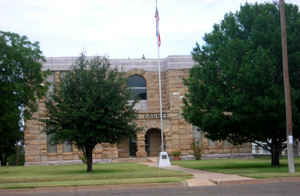
Dickens County is a county located in the state of Texas. Based on the 2010 census, its population was 2,444. Its county seat is Dickens. The county was created in 1876 and later organized in 1891. Both the county and its seat are named for J. Dickens, who died at the Battle of the Alamo
Etymology - Origin of Dickens County Name
J. Dickens, who died at the Battle of the Alamo
Demographics:
County QuickFacts: CensusBureau Quick Facts
Dickens County History
Dickens County is a county located in the US state of Texas. Its county seat is Dickens. The county and city are both named for J. Dickens, who died at the Battle of the Alamo. (It is not certain what the "J" means.)
Handbook of Texas Online
The Wanderers Who Make Bad Camps Band of the Comanches dominated the region before white settlement. The Comanches
became fine horse-mounted warriors and hunters after they adapted their culture to the utilization of Spanish horses
in the seventeenth century. The Comanche Indians hunted buffalo in summer and
fall to provide most of their material needs. They met in an informal general assembly to decide the organization of
their communal hunts, and war leaders made final decisions. A historian writes, "The buffalo was the lifeblood of
Comanche culture; its near-extermination sounded the death knell for the kind of life Comanches had come to know."
White hunters cleared the land of buffalo and wild horses in the 1870s, while Colonel Ranald S. MacKenzie's
Fourth United States Cavalry subdued the Comanches in 1874 and 1875. MacKenzie's
base of operations against the Indians was located at Anderson's Fort, also called Soldiers Mound, an army supply
camp located near the site of present-day Spur. In 1876 the Texas state legislature formed Dickens County from land
previously assigned to Bexar County. More at
John J. Leffler, "DICKENS COUNTY," Handbook of Texas Online (http://www.tshaonline.org/handbook/online/articles/hcd08),
accessed January 23, 2016. Uploaded on June 12, 2010. Published by the Texas State Historical Association.
Geography: Land and Water
As reported by the Census Bureau, the county has a total area of 905 square miles (2,344 km2), of which, 904
square miles (2,342 km2) of it is land and 1 square miles (2 km2) of it (0.11%) is water.
Neighboring Counties
Bordering counties are as follows:
- Motley County (north)
- King County (east)
- Kent County (south)
- Crosby County (west)
Education


Click Image to Enlarge
