


Click Image to Enlarge
Texas Counties
Texas is divided into two hundred and fifty-four counties, more than any other state. Texas was originally divided into municipalities, a unit of local government under Spanish and Mexican rule. When the Republic of Texas gained its independence in 1836, there were 23 municipalities, which became the original Texas counties. Many of these would later be divided into new counties. The most recent county to be created was Kenedy County in 1921. The most recent county to be organized was Loving County in 1931Duval County, Texas
Duval County Education, Geography, and History
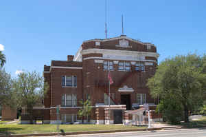
Duval County is a county located in the state of Texas. Based on the 2010 census, its population was 11,782. The county seat is San Diego. The county was founded in 1858 and later organized in 1876. It is named for Burr H. Duval, a soldier in the Texas Revolution who died in the Goliad Massacre.
Etymology - Origin of Duval County Name
Burr Harrison DuVal, a soldier in the Texas Revolution who died in the Goliad Massacre
Demographics:
County QuickFacts: CensusBureau Quick Facts
Duval County History
Even though Duval County lies in the United States, it has long been Mexican in character. A Mexican first surveyed it in 1804, Jose Contrerras, surveyor general of San Luis Potosi. Luis Muniz was born there in 1828, the county's first recorded birth. The important colonists came from Mier, Tamaulipas - and Anglos later respected their descendants as the old Mexican families.
The Texas Legislature established Duval County February 1, 1858. It is named for Burr H. Duval, a soldier in the Texas Revolution who died in the Goliad Massacre. The seat of the county is San Diego
Handbook of Texas Online
In 1858 the Texas legislature formed Duval County, which originally
embraced 1,887 square miles, from parts of Nueces, Live Oak, and Starr
counties. County organization did not occur until eighteen years later. The
county was named for Burr H. Duval, who fought in the Texas
Revolution and was killed in the Goliad Massacre. Duval County
has always been somewhat off the beaten track of development. In 1867 Father
Claude Jaillet built a church in San Diego that became the only
public place of worship between Corpus Christi and the Rio Grande. Despite
this civilizing influence, however, Duval County could still be a wild and
dangerous place. In 1873 the outlaw Alberto Garza
and some sixty followers made the county the center of their horse-stealing
and cattle-skinning operations. They sent orders to the citizens of San
Diego to bring enough money to buy the stolen hides or enough men to skin
the hide-peelers. A party of Anglos chose the latter option, attacked the
outlaw's camp, and scattered the rustlers. Five years later, in mid-April
1878, a band of forty Lipan Apache, Seminole, and Kickapoo Indians,
reportedly led by a blond white man, cut a swath through Webb and Duval
counties, murdering and pillaging several ranches before dispersing. The
perpetrators of the so-called "Great Raid of '78" were never caught. A
legend of more recent vintage holds that Francisco (Pancho) Villa
may have buried two saddlebags of silver in the area. The county was finally
organized in 1876, and San Diego was selected as the county seat. James O.
Luby,
the first county judge, dominated Duval County politics for most of the next
three decades. When Luby defected from the Democratic to the Republican
party, he almost singlehandedly made the GOP an important
factor in Duval County politics. The battles between the Botas and Guaraches
("boots" and "sandals," or Republicans and Democrats) were often ferocious More at
Martin Donell Kohout, "DUVAL COUNTY," Handbook of Texas Online (http://www.tshaonline.org/handbook/online/articles/hcd11),
accessed January 23, 2016. Uploaded on June 12, 2010. Published by the Texas State Historical Association.
Geography: Land and Water
As reported by the Census Bureau, the county has a total area of 1,796
square miles (4,651 km2), of which, 1,793 square miles (4,643 km2) of it is
land and 3 square miles (8 km2) of it (0.17%) is water.
Neighboring Counties
Bordering counties are as follows:
- McMullen County (north)
- Live Oak County (northeast)
- Jim Wells County (east)
- Brooks County (southeast)
- Jim Hogg County (southwest)
- Webb County (west)
Education


Click Image to Enlarge
