


Click Image to Enlarge
Texas Counties
Texas is divided into two hundred and fifty-four counties, more than any other state. Texas was originally divided into municipalities, a unit of local government under Spanish and Mexican rule. When the Republic of Texas gained its independence in 1836, there were 23 municipalities, which became the original Texas counties. Many of these would later be divided into new counties. The most recent county to be created was Kenedy County in 1921. The most recent county to be organized was Loving County in 1931Ellis County, Texas
Ellis County Education, Geography, and History
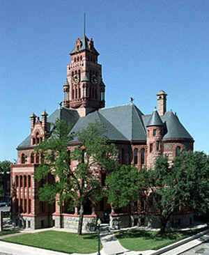
Ellis County is a county located in the state of Texas. Based on the 2010 census, its population was 149,610. The county seat is Waxahachie.
The county was founded in 1849 and organized the next year. It is named for Richard Ellis, president of the convention that produced the Texas
Declaration of Independence.
Ellis County is included in the Dallas-Fort Worth-Arlington, TX Metropolitan Statistical Area.
Etymology - Origin of Ellis County Name
Richard Ellis, president of the convention that produced the Texas Declaration of Independence
Demographics:
County QuickFacts: CensusBureau Quick Facts
Ellis County History
Ellis County is a county located in the US state of Texas. It is named for Richard Ellis, president of the convention that produced the Texas Declaration of Independence. The seat of the county is Waxahachie
Handbook of Texas Online
Acting on a bill sponsored by Gen. Edward H. Tarrant, the state legislature
officially established Ellis County on December 20, 1849. It was drawn from Navarro County, organized in February of
the following year, and probably named for Richard Ellis, president of the
Convention of 1836. Waxahachie was named the county seat and established on land
donated by E. W. Rogers in August 1850. William Hawkins was the first chief justice (county judge). Judge Oran Milo
Roberts presided over the first term of the Ellis County district court during
the fall of 1850. A boundary dispute with Johnson County was temporarily settled during Reconstruction,
when Ellis County ceded nearly 100 square miles of land. The argument resurfaced in the late 1880s and was finally
peaceably settled by a new survey of the line in 1939 More at
Robert J. Haaser, "ELLIS COUNTY," Handbook of Texas Online (http://www.tshaonline.org/handbook/online/articles/hce04),
accessed January 23, 2016. Uploaded on June 12, 2010. Published by the Texas State Historical Association.
Geography: Land and Water
As reported by the Census Bureau, the county has a total area of 952 square miles (2,465 km2), of which, 940
square miles (2,434 km2) of it is land and 12 square miles (30 km2) of it (1.23%) is water.
Neighboring Counties
Bordering counties are as follows:
- Dallas County (north)
- Kaufman County (northeast)
- Henderson County (east)
- Navarro County (southeast)
- Hill County (southwest)
- Johnson County (west)
- Tarrant County (northwest)
Education


Click Image to Enlarge
