


Click Image to Enlarge
Texas Counties
Texas is divided into two hundred and fifty-four counties, more than any other state. Texas was originally divided into municipalities, a unit of local government under Spanish and Mexican rule. When the Republic of Texas gained its independence in 1836, there were 23 municipalities, which became the original Texas counties. Many of these would later be divided into new counties. The most recent county to be created was Kenedy County in 1921. The most recent county to be organized was Loving County in 1931Falls County, Texas
Falls County Education, Geography, and History
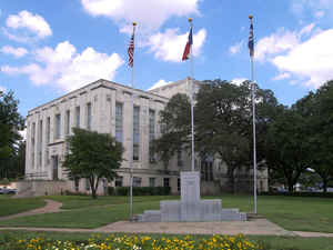
Falls County is a county located in the state of Texas. Based on the 2010 census, its population was 17,866. The county seat is Marlin.
Falls County is included in the Waco, TX Metropolitan Statistical Area.
Etymology - Origin of Falls County Name
It is named for the original 10-foot-tall waterfall on the Brazos River, which existed until the river changed course during a storm in 1866. The present falls can be found two miles northeast of the original falls, at the Falls on the Brazos Park, a camping site located only a few miles out of Marlin on Farm to Market Road 712.
Demographics:
County QuickFacts: CensusBureau Quick Facts
Falls County History
Falls County is a county located in the US state of Texas. It is named for the waterfalls on the Brazos River. Its seat is Marlin
Handbook of Texas Online
On January 28, 1850, the state legislature formed Falls County from Limestone and Milam counties. The falls of
the Brazos gave the county its name. Since Falls County was established its boundaries have not changed. The
legislature stipulated that Viesca would be the county seat, but the citizens petitioned for another location
because most of the residents lived east of the Brazos River. The citizens voted 20-0 in favor of Adams, which
officially became the county seat on January 30, 1851. Soon after, the town was renamed Marlin in honor of the
Marlin family. The settlers of Falls County came from the slaveholding South, primarily Mississippi, Tennessee, and
Alabama. By the census of 1860 the county had 1,716 slaves (47 percent of the total population) and 504 farms. Falls
County relied less on cotton than other Texas counties, harvesting only 2,030 bales in 1860, and relied instead on a
diverse agricultural economy. Wool was a major crop, with 17,500 pounds produced in 1860, the highest in Falls
County history. Cattle was the most important livestock, with 26,310, a total not matched until 1900. More at
Lisa C. Maxwell, "FALLS COUNTY," Handbook of Texas Online (http://www.tshaonline.org/handbook/online/articles/hcf01),
accessed January 23, 2016. Uploaded on June 12, 2010. Published by the Texas State Historical Association.
Geography: Land and Water
As reported by the Census Bureau, the county has a total area of 774 square miles (2,004 km2), of which, 769
square miles (1,992 km2) of it is land and 5 square miles (12 km2) of it (0.61%) is water.
Neighboring Counties
Bordering counties are as follows:
- Limestone County (northeast)
- Robertson County (southeast)
- Milam County (south)
- Bell County (southwest)
- McLennan County (northwest)
Education


Click Image to Enlarge
