


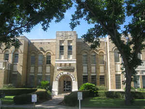
Click Image to Enlarge
Texas Counties
Texas is divided into two hundred and fifty-four counties, more than any other state. Texas was originally divided into municipalities, a unit of local government under Spanish and Mexican rule. When the Republic of Texas gained its independence in 1836, there were 23 municipalities, which became the original Texas counties. Many of these would later be divided into new counties. The most recent county to be created was Kenedy County in 1921. The most recent county to be organized was Loving County in 1931Frio County, Texas
Frio County Education, Geography, and History
Frio County is a county located in the state of Texas. Based on the 2010 census, its population was 17,217. The county seat is Pearsall. The county was created in 1858 and later organized in 1871. Frio is named for the Frio River, whose name is Spanish for "cold".
Etymology - Origin of Frio County Name
the Frio River (Frio is cold in Spanish).
Demographics:
County QuickFacts: CensusBureau Quick Facts
Frio County History
Frio County is a county located in the US state of Texas. It is named for the Frio River. The seat of the county is Pearsall
Handbook of Texas Online
Frio County was formed by the Texas legislature from parts of Atascosa, Bexar, and Uvalde counties on February 1,
1858, but was not organized until May 22, 1871. In the interim the county remained under the jurisdiction of Bexar
County. In accordance with the 1871 legislative mandate the county seat was named Frio and located on the William
Eastwood Rancho near the Presidio Road Crossing. This site was chosen because of the promise of irrigated farming
offered by the Frio River, as well as the townsite's proximity to the Presidio Road. Elections for the county's
first justices of the peace were held at the rancho between July 17 and 20, 1871. More at
Ruben E. Ochoa, "FRIO COUNTY," Handbook of Texas Online (http://www.tshaonline.org/handbook/online/articles/hcf10),
accessed January 23, 2016. Uploaded on June 12, 2010. Published by the Texas State Historical Association.
Geography: Land and Water
As reported by the Census Bureau, the county has a total area of 1,134 square miles (2,938 km2), of which,
1,133 square miles (2,935 km2) of it is land and 1 square miles (3 km2) of it (0.11%) is water.
Neighboring Counties
Bordering counties are as follows:
- Medina County (north)
- Atascosa County (east)
- La Salle County (south)
- Dimmit County (southwest)
- Zavala County (west)
Education


Click Image to Enlarge
