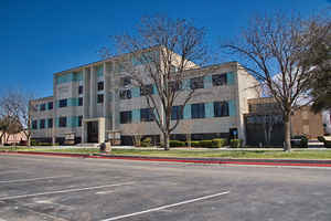
Texas Counties
Texas is divided into two hundred and fifty-four counties, more than any other state. Texas was originally divided into municipalities, a unit of local government under Spanish and Mexican rule. When the Republic of Texas gained its independence in 1836, there were 23 municipalities, which became the original Texas counties. Many of these would later be divided into new counties. The most recent county to be created was Kenedy County in 1921. The most recent county to be organized was Loving County in 1931Gaines County, Texas
Gaines County Education, Geography, and History

Gaines County is a county located in the state of Texas. Based on the 2010 census, its population was 17,526. The county seat is Seminole. The county was created in 1876 and later organized in 1905. It is named for James Gaines, a merchant who signed the Texas Declaration of Independence.
Etymology - Origin of Gaines County Name
James Gaines, merchant and signer of the Texas Declaration of Independence
Demographics:
County QuickFacts: CensusBureau Quick Facts
Gaines County History
Gaines County is a county located in the US state of Texas. Gaines County is named for James Gaines, a merchant who signed the Texas Declaration of Independence. The seat of the county is Seminole.
Handbook of Texas Online
The area was Comanche country until the United States Army campaigns of 1875 and 1876. An Indian burial mound has
been excavated near Cedar Lake. It is believed that Quanah Parker, the last
great Comanche chief, was born in the vicinity. Cedar Lake was also the site of a skirmish between Indians and
United States cavalrymen in October 1875. Buffalo hunters moved into the region in the 1870s, and some of them began
ranches and remained in the area after their game had disappeared; the land was plush with grama grasses but limited
in surface water. In 1876 the Texas legislature formed Gaines County from Bexar County. Gaines County was attached
to Bexar County for administrative purposes in 1876, then to Shackelford County in 1877 and to Martin County in
1885. As early as 1879 ranchman C. C. Slaughter ran herds on much of eastern
Gaines County from his headquarters at Rattlesnake Canyon. C. C. Meddin, who moved his family and herd to Gaines
County in 1880, was the first permanent settler; the United States census reported only eight people in the county
in 1880. In the 1880s and 1890s other ranchers moved into the area, including C. M. Breckon, the Brunson brothers,
Bill Anderson, Dave Ernest, Robinson and Winfield Scott of the Hat Ranch, C. Bill Higgins of the Wishbone Ranch, J.
E. Millhollon of the MH Ranch, and the several owners of the Triangle H Triangle north of Seminole. Until the early
twentieth century cattle raising was the only industry in the county. The population was sixty-eight in 1890 and
fifty-five in 1900, when six ranches. More at
William R. Hunt, "GAINES COUNTY," Handbook of Texas Online (http://www.tshaonline.org/handbook/online/articles/hcg01),
accessed January 23, 2016. Uploaded on June 15, 2010. Published by the Texas State Historical Association.
Geography: Land and Water
As reported by the Census Bureau, the county has a total area of 1,503 square miles (3,892 km2), of which,
1,502 square miles (3,891 km2) of it is land and 1 square miles (1 km2) of it (0.03%) is water.
Neighboring Counties
Bordering counties are as follows:
- Yoakum County (north)
- Terry County (north)
- Dawson County (east)
- Martin County (southeast)
- Andrews County (south)
- Lea County, New Mexico (west)
Education


