


Click Image to Enlarge
Texas Counties
Texas is divided into two hundred and fifty-four counties, more than any other state. Texas was originally divided into municipalities, a unit of local government under Spanish and Mexican rule. When the Republic of Texas gained its independence in 1836, there were 23 municipalities, which became the original Texas counties. Many of these would later be divided into new counties. The most recent county to be created was Kenedy County in 1921. The most recent county to be organized was Loving County in 1931Gray County, Texas
Gray County Education, Geography, and History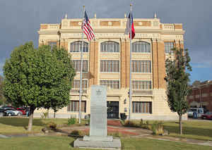
Gray County is a county located in the state of Texas. Based on the 2010 census, its population was 22,535. The county seat is Pampa.
The county was crated in 1876 and later organized in 1902. is named for Peter W. Gray, a Confederate lawyer and soldier in the American
Civil War.
Gray County comprises the Pampa, TX Micropolitan Statistical Area.
Etymology - Origin of Gray County Name
Peter W. Gray, a lawyer and soldier in the Civil War
Demographics:
County QuickFacts: CensusBureau Quick Facts
Gray County History
Gray County is a county located in the US state of Texas.Gray County is named for Peter W. Gray, a Confederate lawyer and soldier in the American Civil War. The seat of the county is Pampa
Handbook of Texas Online
Gray County, formed in 1876 out of the Bexar District, was named for Peter W. Gray,
a lawyer and politician of the Republic of Texas and Civil War
eras. The county's prehistoric Plains Apache inhabitants gave way to the Apaches, who in turn were
displaced by the Comanches and Kiowas. These peoples dominated the Panhandle until they were crushed
in the Red River War of 1874 and removed to Indian Territory.
With Gray County for settlement, ranchers began to reach the region as early as 1877. In 1878 a
well-known local rancher, Perry LeFors, established a small ranch on Cantonment Creek. Other small
ranching operations developed in the eastern part of the county. In 1882 the Francklyn Land and
Cattle Company purchased a huge tract of land that included the
western part of Gray County. The company failed in 1886 and was reorganized as the White Deer Lands
(formally the White Deer Lands Trust of British bondholders), which operated the huge Diamond F
Ranch. For the rest of the nineteenth century Gray County remained the domain of cattle ranchers.
The population, 56 in 1880, rose only to 203 in 1890 and 480 by 1900. A ranching economy with little
need for manpower occupied the area. By the turn of the century the county's stable stock-farming
population felt a growing need for self-government. As a result, in 1902 the county was organized
with Lefors as the county seat. Lefors, a tiny ranching town, remained the county seat until 1928,
when Pampa's oil-induced growth led to its becoming the county seat.
More at
Donald R. Abbe, "GRAY COUNTY," Handbook of Texas Online (http://www.tshaonline.org/handbook/online/articles/hcg08),
accessed January 23, 2016. Uploaded on June 15, 2010. Published by the Texas State Historical Association.
Geography: Land and Water
As reported by the Census Bureau, the county has a total area of 929 square miles (2,407 km2),
of which, 928 square miles (2,404 km2) of it is land and 1 square miles (3 km2) of it (0.10%) is
water.
Neighboring Counties
Bordering counties are as follows:
- Roberts County (north)
- Wheeler County (east)
- Donley County (south)
- Carson County (west)
Education


Click Image to Enlarge
