


Click Image to Enlarge
Texas Counties
Texas is divided into two hundred and fifty-four counties, more than any other state. Texas was originally divided into municipalities, a unit of local government under Spanish and Mexican rule. When the Republic of Texas gained its independence in 1836, there were 23 municipalities, which became the original Texas counties. Many of these would later be divided into new counties. The most recent county to be created was Kenedy County in 1921. The most recent county to be organized was Loving County in 1931Hansford County, Texas
Hansford County Education, Geography, and History
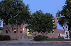
Hansford County is a county located in the state of Texas. Based on the 2010 census, its population was 5,613. Its county seat is Spearman. The county was created in 1876 and organized in 1889. It is named for John M. Hansford, a Texas state congressman and judge.
Etymology - Origin of Hansford County Name
John M. Hansford, a Texas state congressman and judge, who was shot and killed by a mob
Demographics:
County QuickFacts: CensusBureau Quick Facts
Hansford County History
Artifacts of the Antelope Creek Indian culture abound along the Canadian valley in Hutchinson County.
Archaeologists have found 1,300 acres (5.3 km2) of Alibates flint in the area that was used as a quarry for shaping flint tools. Nomadic
Plains Apache also camped in this area as did Comanche, Arapaho, Kiowa, and Cheyenne.
In 1873 English brothers James Hamilton Cator and Arthur J. L. (Bob) Cator were sent by their father, British naval officer Captain John
Bertie Cator, to Kansas in search of financial opportunity. The brothers soon found their true calling as buffalo hunters and established an
outpost along the North Palo Duro Creek. They named this camp Zulu, and it soon became known as Zulu Stockade.
The depletion of the buffalo herds led in part to the ongoing conflict between Indians and settlers. The Second Battle of Adobe Walls took
place in neighboring Hutchinson County in 1874 and led to the Red River War of 1874-1875. A group of buffalo hunters attempted a
revitalization of Fort Adobe. The Comanches, Cheyenne, Arapaho and Kiowa saw the fort and the decimation of the buffalo herd as a threat to
their existence. Comanche medicine man Isa-tai prophesized a victory and immunity to the white man's bullets in battle. Quanah Parker lead
several hundred in a raid on the fort. The buffalo hunters were able to force the Indians into retreat. The Red River War of 1874-1875 was a
United States Army campaign to force the removal of Indians in Texas and their relocation to reservations, to open the region to white
settlers.
The Texas legislature formed Hansford County in 1876 from Young and Bexar counties. The county was organized in 1889. The town of Hansford
became the first county seat. The county is named for John M. Hansford, a Texas
state congressman and judge. Its seat is Spearman.
Handbook of Texas Online
The two Cator brothers and their sister Clara, together with some other hunters, remained to take up ranching and
were soon joined by others seeking new ranges for beef cattle. In 1876 the Texas legislature marked off Hansford
County from land previously assigned to Young and Bexar districts; the new county was administered by authorities in
Wheeler County. By 1880 the United States census counted eighteen people living in the county. That same year the
county's first town, Farwell, was established near the center of the county; in 1887 Hansford, a stage stop on the
old Tascosa-Dodge City Trail, was established near Farwell on Palo Duro Creek.
In 1889, when the county was politically organized, Hansford outpolled Farwell in a county-seat election. More at
H. Allen Anderson, "HANSFORD COUNTY," Handbook of Texas Online (http://www.tshaonline.org/handbook/online/articles/hch04),
accessed January 23, 2016. Uploaded on June 15, 2010. Published by the Texas State Historical Association.
Geography: Land and Water
As reported by the Census Bureau, the county has a total area of 920 square miles (2,384 km2), of which, 919 square miles (2,382 km2) of it is land and 1 square miles (2 km2) of it (0.07%) is water.
Neighboring Counties
Bordering counties are as follows:
- Texas County, Oklahoma (north)
- Ochiltree County (east)
- Roberts County (southeast)
- Hutchinson County (south)
- Sherman County (west)
Education


Click Image to Enlarge
