


Click Image to Enlarge
Texas Counties
Texas is divided into two hundred and fifty-four counties, more than any other state. Texas was originally divided into municipalities, a unit of local government under Spanish and Mexican rule. When the Republic of Texas gained its independence in 1836, there were 23 municipalities, which became the original Texas counties. Many of these would later be divided into new counties. The most recent county to be created was Kenedy County in 1921. The most recent county to be organized was Loving County in 1931Hutchinson County, Texas
Hutchinson County Education, Geography, and History
Hutchinson County is a county in the state of Texas. Based on the 2010 census, its population was 22,150. Its county seat is Stinnett. The
county was created in 1876 but not organized until 1901. It is named for Andrew Hutchinson, an early Texas attorney.
Hutchinson County comprises the Borger, TX Micropolitan Statistical Area, which is also included in the Amarillo-Borger, TX Combined
Statistical Area. It is located in the northern portion of the Texas Panhandle.
Etymology - Origin of Hutchinson County Name
Andrew Hutchinson, an early attorney in Texas
Demographics:
County QuickFacts: CensusBureau Quick Facts
Hutchinson County History
Artifacts of the Antelope Creek Indian culture abound along the Canadian valley in Hutchinson County.
Archaeologists have found 1,300 acres (5.3 km2) of Alibates flint in the area that was used as a quarry for shaping flint tools. Nomadic
Plains Apache also camped in this area as did Comanche, Arapaho, Kiowa, and Cheyenne.
Bent, St. Vrain and Company established a trading post in this area to tap into Indian trading. Known as Fort Adobe, it was blown up by
traders three years later due to Indian depredations. The ruins became known as Adobe Walls.
The First Battle of Adobe Walls took place in 1864 when General James H. Carleton sent Col. Christopher (Kit) Carson into the area to avenge
for repeated Indian attacks. Carson and several hundred cavalry officers were greatly outnumbered by Kiowa and Comanche and forced to retreat.
The Second Battle of Adobe Walls took place in 1874. A group of buffalo hunters attempted a revitalization of Fort Adobe. The Comanches,
Cheyenne, Arapaho and Kiowa saw the fort and the decimation of the buffalo herd as a threat to their existence. Comanche medicine man Isa-tai
prophesized a victory and immunity to the white man's bullets in battle. Quanah Parker lead several hundred in a raid on the fort. The buffalo
hunters were able to force the Indians into retreat.
Hutchinson County was established in 1876. The county was not organized until 1901, at which time Plemons became the county seat. For the next
four decades ranching dominated the county's economy, while crop cultivation slowly made gradual headway. Stinnett became county seat after a
special election on September 18, 1926. Hutchinson County is named for Andrew Hutchinson, an early Texas attorney.
Handbook of Texas Online
After its boundaries were established, Hutchinson County was attached for administrative purposes to Wheeler County
and then to Carson County. In the spring of 1901 a movement was begun for its organization. Elections were held on
April 25, and on May 13 the county was officially organized with the riverside town of Plemons as its seat of
government. W. H. Ingarton was elected county judge, and William (Billy) Dixon,
the Adobe Walls hero who had operated the county's first post office on the Turkey Track, was the first sheriff. By
1910 the population had reached 892, and the county was divided into sixteen school districts. More at
H. Allen Anderson, "HUTCHINSON COUNTY," Handbook of Texas Online (http://www.tshaonline.org/handbook/online/articles/hch23),
accessed January 24, 2016. Uploaded on June 15, 2010. Published by the Texas State Historical Association.
Geography: Land and Water
As reported by the Census Bureau, the county has a total area of 895 square miles (2,318 km2), of which, 887
square miles (2,298 km2) of it is land and 8 square miles (20 km2) of it (0.85%) is water.
Neighboring Counties
Bordering counties are as follows:
- Hansford County (north)
- Roberts County (east)
- Carson County (south)
- Moore County (west)
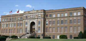
Education


Click Image to Enlarge
