


Click Image to Enlarge
Texas Counties
Texas is divided into two hundred and fifty-four counties, more than any other state. Texas was originally divided into municipalities, a unit of local government under Spanish and Mexican rule. When the Republic of Texas gained its independence in 1836, there were 23 municipalities, which became the original Texas counties. Many of these would later be divided into new counties. The most recent county to be created was Kenedy County in 1921. The most recent county to be organized was Loving County in 1931Irion County, Texas
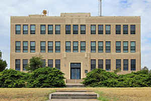
Irion County Education, Geography, and History
Irion County is a county located on the Edwards Plateau in the state of Texas. Based on the 2010 census, its population was 1,599. Its
county seat is Mertzon. The county is named for Robert Anderson Irion, a secretary of state of the Republic of Texas.
Irion County is included in the San Angelo, TX Metropolitan Statistical Area.
Etymology - Origin of Irion County Name
Robert Anderson Irion, a secretary of state in the Republic of Texas
Demographics:
County QuickFacts: CensusBureau Quick Facts
Irion County History
Irion County is a county located in the US state of Texas. Its county seat is Mertzon. The county is named for Robert Anderson Irion, a secretary of state of the Republic of Texas.
Handbook of Texas Online
Cattle and sheep thrived on the well-watered range. John Arden brought the first flock of sheep from California
in 1876, and in 1880 the 7D Ranch was established by Billy Childress with longhorn cattle
from Atascosa County. Beginning in the 1880s a few pioneer farmers built small irrigation
systems, and several ranchmen planted hay and grain. Underground water resources were tapped with windmill-driven
pumps; the first cotton crop was planted in 1886 by W. H. White. In 1889 the Texas legislature formed Irion County
from Tom Green County, and that same year the county was organized with Sherwood county seat. By 1890, 118 farms and
ranches, encompassing 193,000 acres, had been established in the county. Though fourteen of these were larger than
1,000 acres, many were relatively small holdings; the average size was 1,627 acres. Nevertheless, ranching
dominated the local economy; almost 64,000 cattle and over 42,000 sheep were reported in the county that year, when
only 218 acres was planted in corn (the county's most important crop) and fourteen in cotton. The United States
census counted 870 residents that year. By 1900 the number of farms and ranches declined to fifty-two, and the
population dropped to 848 More at
William R. Hunt and John Leffler, "IRION COUNTY," Handbook of Texas Online (http://www.tshaonline.org/handbook/online/articles/hci01),
accessed January 24, 2016. Uploaded on June 15, 2010. Published by the Texas State Historical Association.
Geography: Land and Water
As reported by the Census Bureau, the county has a total area of 1,052 square miles (2,724 km2), virtually all
of which is land.
Neighboring Counties
Bordering counties are as follows:
- Tom Green County (north and east)
- Schleicher County (southeast)
- Crockett County (southwest)
- Reagan County (west)
Education


Click Image to Enlarge
