


Click Image to Enlarge
Texas Counties
Texas is divided into two hundred and fifty-four counties, more than any other state. Texas was originally divided into municipalities, a unit of local government under Spanish and Mexican rule. When the Republic of Texas gained its independence in 1836, there were 23 municipalities, which became the original Texas counties. Many of these would later be divided into new counties. The most recent county to be created was Kenedy County in 1921. The most recent county to be organized was Loving County in 1931Kenedy County, Texas
Kenedy County Education, Geography, and History
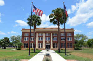
Kenedy County is a county located in the state of Texas. Based on the 2010 census, its population was 416. It is the third-least populous
county in Texas and fourth-least populous in the United States. Its county seat is Sarita. The county was created in 1921 from parts of
Hidalgo and Willacy counties and is named for Mifflin Kenedy, an early area rancher and steamboat operator.
Kenedy County is included in the Kingsville, TX Kingsville Micropolitan Statistical Area, which is also included in the Corpus
Christi-Kingsville-Alice, TX Combined Statistical Area. There are no incorporated municipalities in Kenedy County.
Etymology - Origin of Kenedy County Name
Mifflin Kenedy, an early rancher in the area
Demographics:
County QuickFacts: CensusBureau Quick Facts
Kenedy County History
Kenedy County is a county located in the US state of Texas. Its seat is Sarita, and the county is named for Mifflin Kenedy, an early rancher in the area. Kenedy County has the distinction of having the fourth lowest-population of any county in the United States, following Loving County, Texas, Kalawao County, Hawaii, and King County, Texas. It is also the easternmost county in the United States that has more square miles than people. The county was created in 1921 from parts of Hidalgo and Willacy counties. In 1999, Hurricane Bret struck the county, but damage was minimal due to the county's low population. A wind turbine plant is being built near Sarita and is expected to slightly raise the population of the area.
Handbook of Texas Online
Kenedy County, among the last Texas counties formed, was not established until 1921, when Willacy, Cameron, and
Hidalgo counties were reorganized. The stated reason for the county's formation was the considerable distance to the
county seats of the other counties. But perhaps more important was the attempt of ranching interests to stave off
the growing power of farmers who were beginning to develop the Rio Grande valley. The new county seat was
established at Sarita, where John G. Kenedy, son of the founder of the King Ranch, had built his headquarters. Since
that time the county has changed little. Although Kenedy County was a ranching area from the advent of the Spanish
to the early 1990s, there have never been more than twenty-five ranches in the county, and most of the land still
remains in the hands of the Armstrong, King, Kenedy, and Yturria interests. In 1930 there were thirteen ranches in
Kenedy County, with an average size of 61,500 acres. By 1945, after several consolidations, there were only seven
ranches, averaging 70,130 acres. During the peak years of ranching there were more than 80,000 head of cattle in the
county. Although that number subsequently decreased, the county remains an important ranching center. Small
amounts of sorghum, hay, and cotton are grown, but livestock and livestock products still account for more than 90
percent of agricultural receipts. In the early 1990s about three-fourths of the land was in farms and ranches, with
less than 1 percent under cultivation. Oil was discovered in the county in 1947, and in the early 1990s oil and
natural gas accounted for the largest source of nonfarm earnings. Production of crude oil in 1990 was 643,446
barrels; between 1947 and January 1, 1991, a total of 31,800,494 barrels was produced. More at
Alicia A. Garza, "KENEDY COUNTY," Handbook of Texas Online (http://www.tshaonline.org/handbook/online/articles/hck04),
accessed January 24, 2016. Uploaded on June 15, 2010. Published by the Texas State Historical Association.
Geography: Land and Water
As reported by the Census Bureau, the county has a total area of 1,946 square miles (5,039 km2), of which,
1,457 square miles (3,773 km2) of it is land and 489 square miles (1,266 km2) of it (25.12%) is water. The area made
Kenedy the 13th largest county in Texas in total area. In land area only, it is the 25th-largest county in Texas.
Neighboring Counties
Bordering counties are as follows:
- Kleberg County (north)
- Gulf of Mexico (east)
- Willacy County (south)
- Hidalgo County (southwest)
- Brooks County (west)
Education
Almost all of Kenedy County is served by Sarita Elementary School (PreK-6) of the Kenedy County Wide Common School District. Of the nine
Texas counties having only one school apiece, the population of Sarita Elementary School was the smallest.
A small portion of Kenedy County is served by the Riviera Independent School District.


Click Image to Enlarge
