


Click Image to Enlarge
Texas Counties
Texas is divided into two hundred and fifty-four counties, more than any other state. Texas was originally divided into municipalities, a unit of local government under Spanish and Mexican rule. When the Republic of Texas gained its independence in 1836, there were 23 municipalities, which became the original Texas counties. Many of these would later be divided into new counties. The most recent county to be created was Kenedy County in 1921. The most recent county to be organized was Loving County in 1931Kerr County, Texas
Kerr County Education, Geography, and History
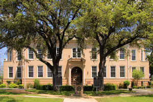
Kerr County is a county located on the Edwards Plateau in the state of Texas. Based on the 2010 census, its population was 49,625. Its
county seat is Kerrville. The county was named by Joshua D. Brown for his fellow Kentucky native, James Kerr, a congressman of the Republic of
Texas.
The Kerrville, TX Micropolitan Statistical Area includes all of Kerr County.
Etymology - Origin of Kerr County Name
James Kerr, an early colonist in Texas and soldier in the Texas Revolution
Demographics:
County QuickFacts: CensusBureau Quick Facts
Kerr County History
Around 8000 BC, early Native American inhabitants arrived in the area, with numerous successive cultures following in
prehistoric times. Historic tribes encountered by Europeans included the Kiowa, Comanche, and Lipan Apache.
In 1842, the AdelsvereinFisher-Miller Land Grant set aside 3,000,000 acres (12,000 km2) to settle 600 families and single men of German,
Dutch, Swiss, Danish, Swedish, and Norwegian ancestry in Texas. Henry Francis Fisher sold his interest in the land grant to the Adelsverein in
1844.
In 1845, Prince Carl of Solms-Braunfels secured the title to 1,265 acres (5.12 km2) of the Veramendi grant, including the Comal Springs and
River, for the Adelsverein. Thousands of German immigrants were stranded at port of disembarkation, Indianaola on Matagorda Bay. With no food
or shelter, living in holes dug into the ground, an estimated 50% die from disease or starvation. Joshua Brown, in 1846, became the first
settler.
The Texas State Convention of Germans met in San Antonio on May 14-15, 1854, and adopted a political, social, and religious platform,
including: 1) Equal pay for equal work, 2) Direct election of the President of the United States, 3) Abolition of capital punishment, 4)
“Slavery is an evil, the abolition of which is a requirement of democratic principles..â€, 5) Free schools - including universities - supported
by the state, without religious influence, and 6) Total separation of church and state. The next year, United States Army post Camp Verde was
established.
Kerr County was formed in 1856 from Bexar Land District Number 2. Joshua Brown donated the land that became Kerrville, and had it named for
his friend James Kerr. Kerrville was named the county seat. Kerr County is named for
James Kerr, a congressman of the Republic of Texas.
Handbook of Texas Online
On January 26, 1856, Kerr County was formed from Bexar Land District Number 2. Brownsborough changed its name to
Kerrville and became the county seat. The county was organized and held its first election in March of that year.
For several years the new county seat grew slowly due to its remoteness and exposure to Indian attacks, and in 1860
county residents decided to move the county seat to Comfort, a more well-established community to the east. Two
years later, when Comfort became part of the newly established Kendall County, the county seat was returned to
Kerrville. By 1860 Kerr County had a population of 634, including 49 black slaves. While one planter owned
twenty-one slaves, the remainder of the slaves were scattered among thirteen slaveowners. Many settlers had come to
the county from the upper south, particularly from Tennessee, while substantial numbers of German immigrants moved
down from the settlements at Fredericksburg and New Braunfels. Cattle and sheep ranching established an early
dominance over the county economy; by 1860 there were over 4,000 cattle and 1,100 sheep, while only 2,201 acres of
farmland were devoted to crops. A second community, Zanzenberg (later renamed Center Point), was established
southeast of Kerrville and received a post office in 1859 More at
Mark Odintz, "KERR COUNTY," Handbook of Texas Online (http://www.tshaonline.org/handbook/online/articles/hck06),
accessed January 24, 2016. Uploaded on June 15, 2010. Published by the Texas State Historical Association.
Geography: Land and Water
As reported by the Census Bureau, the county has a total area of 1,108 square miles (2,869 km2), of which,
1,106 square miles (2,865 km2) of it is land and 2 square miles (4 km2) of it (0.14%) is water.
Neighboring Counties
Bordering counties are as follows:
- Kimble County (north)
- Gillespie County (northeast)
- Kendall County (east)
- Bandera County (south)
- Real County (southwest)
- Edwards County (west)
Education


Click Image to Enlarge
