


Click Image to Enlarge
Texas Counties
Texas is divided into two hundred and fifty-four counties, more than any other state. Texas was originally divided into municipalities, a unit of local government under Spanish and Mexican rule. When the Republic of Texas gained its independence in 1836, there were 23 municipalities, which became the original Texas counties. Many of these would later be divided into new counties. The most recent county to be created was Kenedy County in 1921. The most recent county to be organized was Loving County in 1931Lamb County, Texas
Lamb County Education, Geography, and History
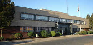
Lamb County is a county located in the state of Texas. Based on the 2010 census, its population was 13,977. Its county seat is Littlefield. The county was created in 1876 but not organized until 1908. It is named for George A. Lamb, who died in the Battle of San Jacinto.
Etymology - Origin of Lamb County Name
George A. Lamb, who lost his life at the Battle of San Jacinto
Demographics:
County QuickFacts: CensusBureau Quick Facts
Lamb County History
Lamb County was formed in 1876 from portions of Bexar County. It was named after George A. Lamb, a soldier in the Battle of San Jacinto.
Handbook of Texas Online
The South Plains of Texas was long the domain of Apachean peoples until they were pushed out of the region by the
more warlike Comanches around 1700. The Comanches ruled the Panhandle-Plains until the Red River War
of 1873-74, when they were crushed by the United States Army. In 1875 the Comanches left the Panhandle-Plains for
reservations in Indian Territory, leaving the region to the buffalo hunters. Between
1876 and 1880 the huge buffalo herds on the Texas Plains were almost exterminated, leaving the area open for occupation
by cattlemen. Lamb County was established by the Texas legislature in 1876 from lands previously assigned to Bexar
County. More at
Donald R. Abbe, "LAMB COUNTY," Handbook of Texas Online (http://www.tshaonline.org/handbook/online/articles/hcl02),
accessed January 24, 2016. Uploaded on June 15, 2010. Published by the Texas State Historical Association.
Geography: Land and Water
As reported by the Census Bureau, the county has a total area of 1,018 square miles (2,636 km2), of which,
1,016 square miles (2,632 km2) of it is land and 2 square miles (4 km2) of it (0.15%) is water.
Neighboring Counties
Bordering counties are as follows:
- Castro County (north)
- Hale County (east)
- Hockley County (south)
- Bailey County (west)
- Parmer County (northwest)
Education


Click Image to Enlarge
