


Click Image to Enlarge
Texas Counties
Texas is divided into two hundred and fifty-four counties, more than any other state. Texas was originally divided into municipalities, a unit of local government under Spanish and Mexican rule. When the Republic of Texas gained its independence in 1836, there were 23 municipalities, which became the original Texas counties. Many of these would later be divided into new counties. The most recent county to be created was Kenedy County in 1921. The most recent county to be organized was Loving County in 1931Limestone County, Texas
Limestone County Education, Geography, and History
Limestone County is a county located in the state of Texas. Based on the 2010 census, the population was 23,384. Its county seat is Groesbeck. The county was created in 1846
Etymology - Origin of Limestone County Name
the limestone deposits in the region
Demographics:
County QuickFacts: CensusBureau Quick Facts
Limestone County History
Indians friendly to the settlers resided in east Texas before the Kiowa, Apache and Comanche intruded upon their
territory. These tribes hunted, farmed the land, and were adept traders. The Tawakoni branch of Wichita Indians originated north of Texas, but
migrated south into east Texas. From 1843 onward, the Tawakoni were part of treaties made by both the Republic of Texas and the United States.
Tawakoni were also sometimes known as Tehuacana. The Limestone County town of Tehuacana was settled on the former site of a Tehuacana village.
The Waco people were also a branch of the Wichita Indians.
Arguably the most infamous Indian depredation in Texas happened in Limestone County on May 19, 1836 when an odd alliance of Comanche, Kiowa,
Caddo and Wichita approached Fort Parker surreptitiously under a flag of peace. The Indians subsequently attacked the fort, killing or
kidnapping all but about 18 settlers who managed to escape to Fort Houston. Captured in the Fort Parker massacre were Elizabeth Kellogg,
Rachel Plummer and her son James Pratt Plummer, John Richard Parker and his sister Cynthia Ann Parker, who later became mother of Comanche
Chief Quanah Parker.
Limestone County was part of the Haden Harrison Edwards (800 families) and Robertson's Colony (800 families) empresario grants made by the
Coahuila y Texas (Texas is the old Spanish name (X had the sound of a J, i.e., Mexia, Bexar, Mexico.) Tejas, though seldom used, is the modern
spelling in Spanish.) legislature in 1825. By contracting how many families each grantee could settle, the government sought to have some
control over colonization.
Baptist spiritual leader Daniel Parker and eight other men organized the Pilgrim Predestinarian Regular Baptist Church in Lamotte, Illinois.
The fellowship in its entirety migrated in 1833 to the new frontier of Texas. Among this group of settlers were Silas M. Parker, Moses Herrin,
Elisha Anglin, Luther T. M. Plummer, David Faulkenberry, Joshua Hadley, and Samuel Frost. Fort Parker, near the Navasota River in what is now
central Limestone County, was the earliest actual settlement in the vicinity. Following on the heels of the original settlers, other
communities were established.
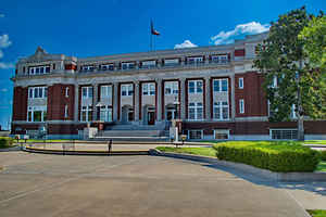
On April 11, 1846, Limestone County was formed from Robertson County. On August 18, 1846, the county was organized. Springfield became the
county seat. The county seat was moved to Groesbeck in 1873 after boundary changes, and the Springfield courthouse being burned down.
Handbook of Texas Online
In the mid-1840s new settlements were established at Springfield and Tehuacana Hills. On April 11, 1846,
Limestone County was formed from Robertson County, and a week later Springfield was established as the county seat.
This town had a population of 120 when it was incorporated in 1848. In 1873, however, when the courthouse burned and
the Houston and Texas Central Railway bypassed the town, an election was ordered and Groesbeck became the county
seat. The organization of the county was completed on August 18, 1846, with the election of county officials.
Limestone County originally included all the land between the Brazos and Trinity rivers on the east and west, and
the land north of Robertson County to Navarro County. In 1848 part of northern and western Limestone County was
taken to form McLennan and Falls counties, and in 1850 part of the eastern section was taken to form part of
Freestone County. The boundaries were changed to their present form on November 2, 1866. More at
Ellen Maschino, "LIMESTONE COUNTY," Handbook of Texas Online (http://www.tshaonline.org/handbook/online/articles/hcl09),
accessed January 24, 2016. Uploaded on June 15, 2010. Published by the Texas State Historical Association.
Geography: Land and Water
As reported by the Census Bureau, the county has a total area of 933 square miles (2,417 km2), of which, 909
square miles (2,354 km2) of it is land and 24 square miles (63 km2) of it (2.60%) is water.
Neighboring Counties
Bordering counties are as follows:
- Navarro County (north)
- Freestone County (northeast)
- Leon County (southeast)
- Robertson County (south)
- Falls County (southwest)
- McLennan County (west)
- Hill County (northwest)
Education


Click Image to Enlarge
