


Click Image to Enlarge
Texas Counties
Texas is divided into two hundred and fifty-four counties, more than any other state. Texas was originally divided into municipalities, a unit of local government under Spanish and Mexican rule. When the Republic of Texas gained its independence in 1836, there were 23 municipalities, which became the original Texas counties. Many of these would later be divided into new counties. The most recent county to be created was Kenedy County in 1921. The most recent county to be organized was Loving County in 1931Live Oak County, Texas
Live Oak County Education, Geography, and History
Live Oak County is a county located in the state of Texas. Based on the 2010 census, its population was 11,531. Its county seat is George West. The county was named for the groves of live oak within its borders.
Etymology - Origin of Live Oak County Name
the Texas live oak tree under which the petition for a new county was signed
Demographics:
County QuickFacts: CensusBureau Quick Facts
Live Oak County History
Live Oak County is a county located in the US state of Texas. . Its county seat is George West
Handbook of Texas Online
Much of the area had been designated part of San Patricio County since 1836, but in 1855 a group of frontiersmen
gathered under a huge live oak tree at Gussettville and drew up a petition asking that a new jurisdiction be
instituted for their settlements. Acceding to their request, the state legislature formed Live Oak County from San
Patricio and Nueces counties on February 2, 1856. Later that year county officials accepted a donation of 640 acres
for the townsite of Oakville, near the old settlement on Sulfur Creek, and designated it the county seat. By 1858,
three settlements in the county-Oakville, Gussettville, and Echo-were considered large enough to be granted post
offices by the federal government; in 1860 the census counted 593 people in Live Oak County, most of them in the
eastern part. In the early years of settlement, residents usually lived on a subsistence level, raising only small
patches of crops, if any, and killing wild game for meat. For money to buy necessary supplies, they relied on the
large herds of wild cattle, hogs, and mustangs that grazed in the area. The
market for cattle and mustangs was limited in the early years of the county, but some cattle were driven to coastal
towns, and mustangs, once broken, could be sold in San Antonio and East Texas. There was greater demand for the
meat, hides, and tallow taken from the many wild hogs in the area. A single family could capture and slaughter as
many as a hundred hogs in a year and sell the products in San Antonio, Tilden, or Oakville. Eighty-five slaves were
counted in Live Oak County in 1860, but since there was virtually no commercial agriculture in the area at the time,
it is not clear how they were employed More at
John Leffler, "LIVE OAK COUNTY," Handbook of Texas Online (http://www.tshaonline.org/handbook/online/articles/hcl11),
accessed January 24, 2016. Uploaded on June 15, 2010. Published by the Texas State Historical Association.
Geography: Land and Water
As reported by the Census Bureau, the county has a total area of 1,079 square miles (2,794 km2), of which,
1,036 square miles (2,684 km2) of it is land and 43 square miles (110 km2) of it (3.94%) is water.
Neighboring Counties
Bordering counties are as follows:
- Karnes County (northeast)
- Bee County (east)
- San Patricio County (southeast)
- Jim Wells County (south)
- Duval County (southwest)
- McMullen County (west)
- tascosa County (northwest)
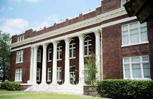
Education


Click Image to Enlarge
